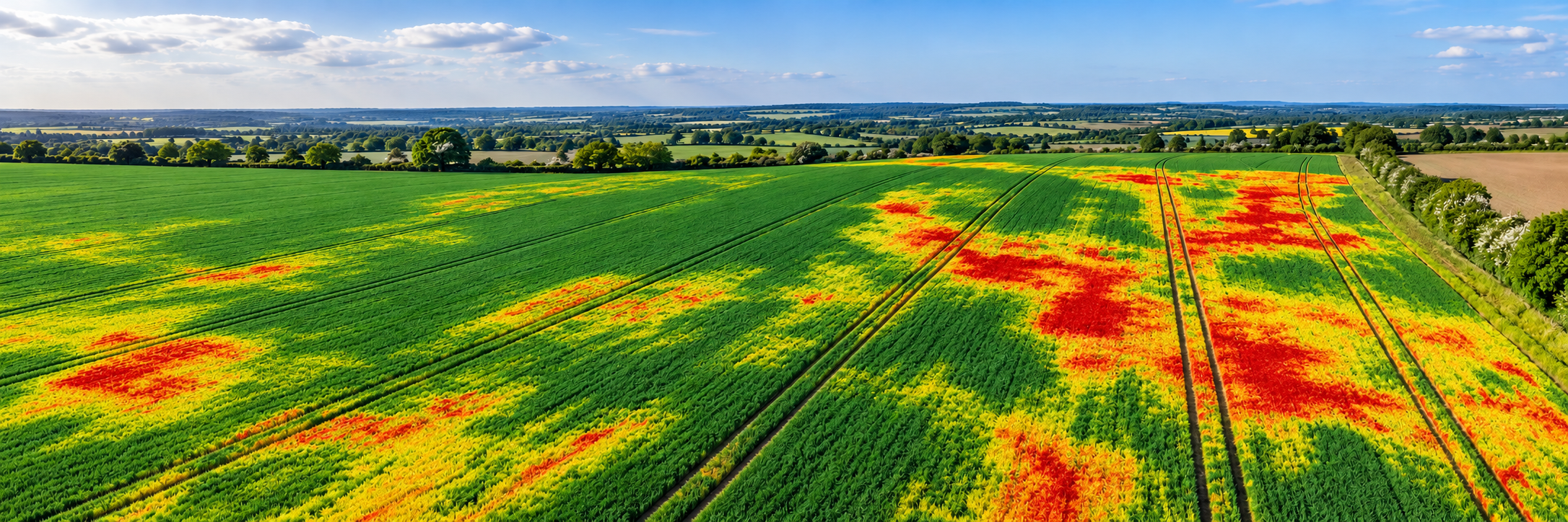
Crop Health Monitoring
Agriculture | Crop Health Monitoring See crop stress earlier. Treat the right areas. Make every…
|
A clearer view of your livestock,
|
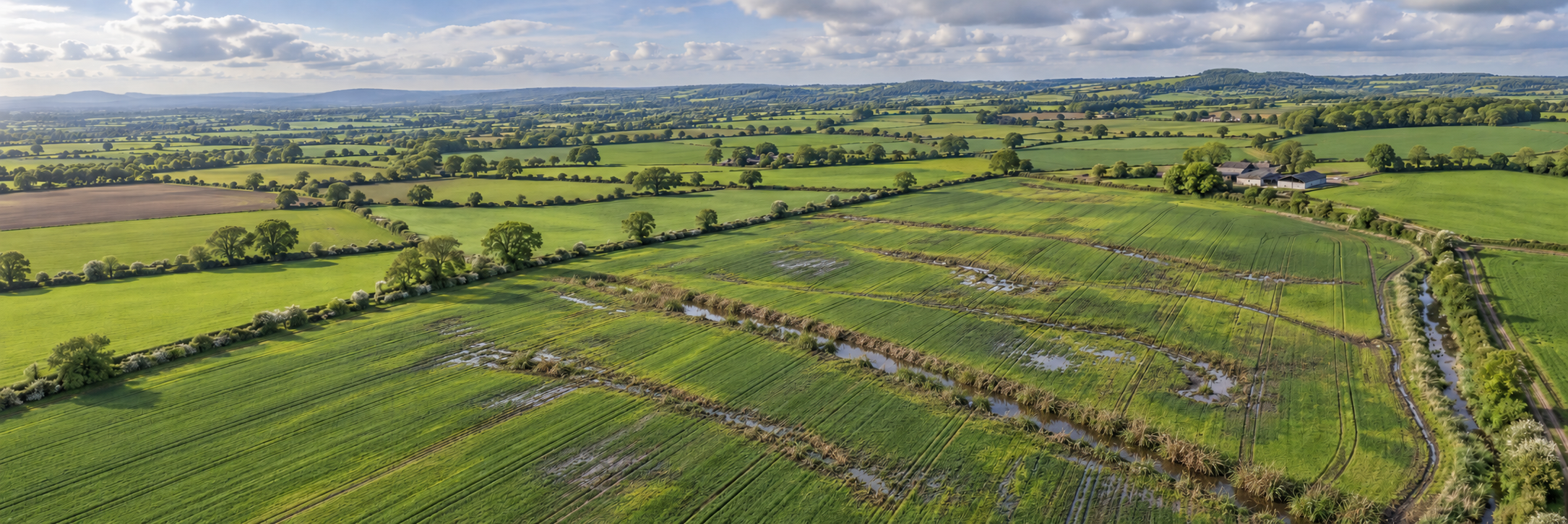
Drone monitoring offers a wider perspective of livestock locations, grazing conditions and the surrounding farm environment. |
|
You cannot always see
|
Where are the animals?
Locate visible cattle or sheep Are all animals accounted for?
Use aerial imagery to support livestock Are grazing conditions suitable?
Review pasture use, standing water, Is farm infrastructure secure?
Examine visible fences, gates, |
Drone Applications
The most useful applications combine
livestock observation with a wider
understanding of the land, grazing
areas and supporting infrastructure.
Identify visible cattle and sheep
across fields and extensive pasture.
Aerial imagery may help estimate
group numbers, locate separated
animals and direct subsequent checks.
Counts still require verification
where animals may be obscured
by vegetation, terrain or buildings.
Observe visible animal movement,
grouping and behaviour from suitable
stand-off positions. Unusual observations
can prompt closer inspection by farm staff.
Drones cannot replace physical animal
welfare assessments or veterinary examination.
Review how grazing land is being used,
identify heavily grazed areas and observe
visible pasture variation, poaching and
waterlogging. Repeat surveys can support
grazing plans and pasture management.
Capture imagery of field boundaries,
fences, gateways, troughs and access
tracks. Potential damage, obstructions
or visible water-supply concerns
can be flagged for subsequent
physical inspection.
From Flight to Farm Decision
A useful livestock monitoring workflow
prioritises animal welfare, safe flying
and practical farm decisions.
Establish the task and likely livestock
locations. Choose suitable aircraft,
sensors and a flight plan that avoids
disturbing animals and complies
with aviation requirements.
Gather photographs or video from
appropriate distances, recording
visible livestock locations,
grazing conditions and
infrastructure concerns.
Interpret observations alongside
farm records and local knowledge.
Direct staff to areas needing
physical checks, maintenance
or further investigation.
Technology in Action
Different drone cameras provide
different information. The best
choice depends on the livestock,
terrain, field size and purpose
of the inspection.
RGB imaging:
Provides a clear aerial overview
of livestock, grazing areas
and farm infrastructure.
Optical zoom:
Helps inspect visible details
from appropriate distances,
reducing the need to approach
animals closely.
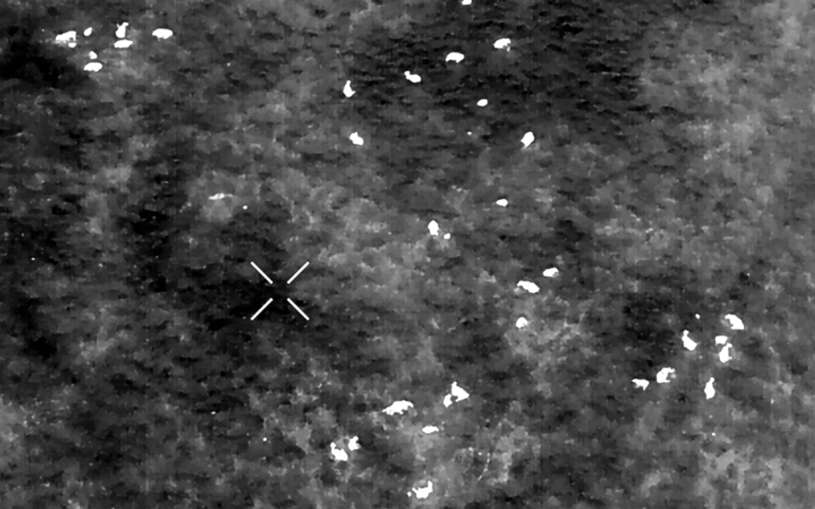
Thermal imaging:
Can reveal animals that contrast
thermally with their surroundings,
supporting location and counting
tasks in suitable conditions.
Mapping:
Creates useful records of
pasture conditions, field access
and infrastructure that
can be compared over time.
Combining the right sensor with
careful interpretation provides
useful information without
replacing essential ground checks.
Why It Matters
Drones can complement traditional farm
visits and livestock checks, providing
additional information across large
or difficult-to-access grazing areas.
An aerial overview can help farm
staff identify which fields or
locations require attention,
potentially reducing time spent
searching extensive grazing areas.
Seeing livestock, field conditions
and infrastructure together provides
useful context for management decisions
and can help highlight unusual situations.
Dated imagery and mapped observations
can support maintenance planning,
grazing reviews and comparisons
of farm conditions over time.
Introducing Drone Technology
Drone operations around livestock
require careful planning. Aircraft
noise, movement and proximity
can affect different animals
in different ways.
Animal welfare:
Maintain suitable stand-off distances,
avoid unnecessary disturbance and
discontinue flights if animals
show signs of distress.
Operational safety:
Account for wind, terrain, visibility
and flight restrictions. Large grazing
areas do not remove the need
for compliant drone operations.
Counting limitations:
Animals hidden by trees, buildings
or uneven terrain may not be visible.
Counts should be verified
where accuracy is important.
Professional judgement:
Observations should complement
established farm procedures.
Physical welfare checks and
veterinary assessment remain essential.
Animal location, counting,
grazing review, infrastructure
inspection or targeted observation?
Consider species, temperament,
breeding periods and sensitivity
to unfamiliar noise and movement.
RGB photography, optical zoom,
thermal imaging or
wider field mapping?
Identify who will investigate
concerns and reconcile
aerial observations
with livestock records.
Establish how aerial information
will support a specific management
task rather than simply
collecting images.
|
See more of your farm.
|
Whether you are a farmer, estate manager |
Whatever you need drones to do, there are three ways to work with Iprosurv.
Our pilots carry out the survey or inspection and deliver the data and reports you need.
Accredited courses that give you and your team the skills to fly safely and legally.
The drones, sensors and software to run your own operations, with expert advice.
Tell us what you are trying to achieve and we will recommend the right service, training or equipment.