Livestock Monitoring & Farm Management
Agriculture | Livestock Monitoring & Farm Management A clearer view of your livestock, grazing land…
|
See crop stress earlier.
|
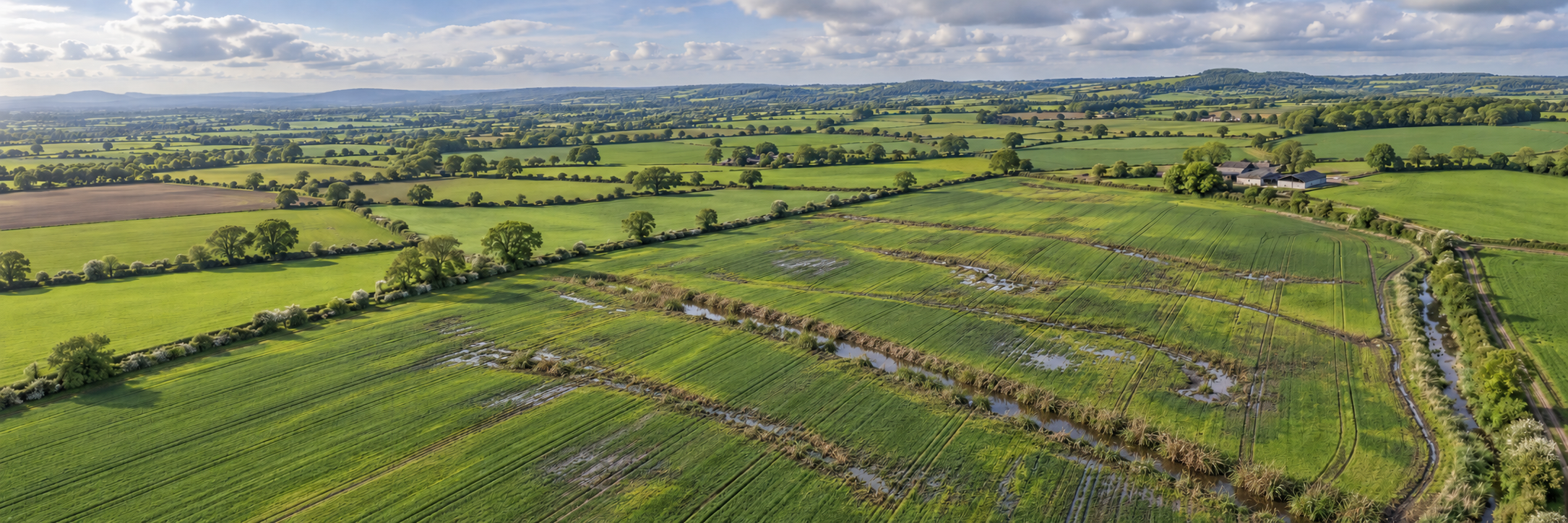
Illustrative multispectral drone survey:
identifying variations in crop response across a field |
|
A field can look healthy
|
Where are crops under stress?
Identify areas with different Is the problem spreading?
Compare surveys over time Does the entire field need treating?
Use verified field information Are inputs delivering value?
Review crop response after |
Drone Applications
Multispectral mapping helps turn
individual field observations
into a more complete picture
of crop development and variability.
Assess variations in vegetation
vigour and chlorophyll-related
response using indices such
as NDVI and NDRE. Areas behaving
differently from the surrounding
crop can be prioritised for
on-the-ground investigation.
Identify patterns that may be
associated with disease,
nutrient deficiency, moisture
problems, pest damage or
other crop stress factors.
Ground inspections and agronomic
assessment are needed to
establish the actual cause.
Convert analysed and verified
field data into management zones
that can inform variable-rate
fertiliser or approved crop
protection applications.
Suitable prescription files
can be prepared for compatible
tractors, spreaders and sprayers.
Repeat flights through the
growing season to compare
emerging patterns, evaluate
crop development and review
the effects of management
interventions. This provides
useful evidence for planning
future cropping decisions.
From Field Survey to Farm Decision
The greatest value comes from
combining accurate aerial data
with agronomic expertise
and practical farm management.
Fly a planned multispectral
mission with appropriate
overlap, positioning and
light calibration to gather
consistent RGB and
spectral imagery.
Process imagery into
orthomosaics and vegetation
index maps. Review unusual
zones and conduct targeted
field checks to understand
the underlying cause.
Combine confirmed findings
with agronomic recommendations
to create management zones,
potential application
prescriptions and records
for repeat monitoring.
Technology in Action
A conventional RGB photograph
shows the visible appearance
of a crop. Multispectral cameras
go further by measuring reflected
light in selected wavelength
bands, including wavelengths
outside human vision.
Healthy and stressed vegetation
can reflect light differently,
particularly around the red-edge
and near-infrared portions
of the spectrum.
NDVI (Normalised Difference
Vegetation Index):
Uses red and near-infrared
reflectance to help assess
vegetation presence, cover
and relative vigour.
NDRE (Normalised Difference
Red Edge Index):
Uses red-edge and near-infrared
information and can be useful
for examining chlorophyll-related
variation in developed crop canopies.
GNDVI (Green Normalised
Difference Vegetation Index):
Uses green and near-infrared
reflectance as another indicator
of vegetation response.
These indices highlight
relative differences. They are
not direct measurements of crop
yield, nitrogen requirement
or disease presence. Results
must be interpreted in relation
to the crop type, growth stage,
weather and field conditions.
Multispectral Sensor Technology
The DJI Mavic 3 Multispectral (Mavic 3M)
combines a 20 MP RGB camera
with four dedicated multispectral
cameras, allowing farmers and
agricultural surveyors to collect
visual and spectral data
within the same mission.
Each spectral band measures
a selected portion of light
reflected from vegetation.
By combining those
measurements, specialist
software calculates
vegetation indices used
in crop assessment.
| Band | Wavelength |
|---|---|
|
Green (G) |
560 nm ± 16 nm |
|
Red (R) |
650 nm ± 16 nm |
|
Red Edge (RE) |
730 nm ± 16 nm |
|
Near-Infrared (NIR) |
860 nm ± 26 nm |
Wavelengths are the manufacturer’s
published centre wavelengths
and nominal bandwidths.
The separate RGB camera captures
normal visible-colour imagery.
Why This Matters
Differences in spectral
reflectance can reveal
crop variability before
some symptoms become
obvious during a normal
visual inspection.
Combined with suitable
survey methodology,
sunlight compensation,
ground control or
positioning verification,
and agronomic checks,
multispectral data
becomes a valuable
monitoring tool.
The DJI Mavic 3M also
includes RTK capability
and a sunlight sensor,
supporting repeatable
image collection and
reflectance processing.
The purpose is not simply
to create a colourful
vegetation map, but to
produce useful information
that a farmer or agronomist
can act upon.
Why It Matters
Precision agriculture is about
putting resources where they
are needed, reducing unnecessary
inputs and supporting productive,
sustainable crop management.
Earlier identification of
unusual crop patterns can
help farmers investigate
developing problems and
intervene at a more
useful stage, potentially
protecting crop quality
and yield.
Where supported by agronomic
evidence, variable-rate
applications can reduce
unnecessary treatment and
direct fertilisers or crop
protection products towards
areas where they are justified.
Avoiding unnecessary
applications may reduce
chemical consumption,
associated production
emissions and some
machinery operations.
Actual environmental
savings depend on the
management decisions
made from the data.
Introducing Precision Agriculture
Multispectral surveys can
provide powerful information,
but successful crop monitoring
depends on planning,
interpretation and
collaboration between
drone operators, farmers
and agronomists.
Timing and crop stage:
Flights should be planned
around the crop’s development
and the question being asked.
Different growth stages can
affect the usefulness
of vegetation indices.
Lighting and calibration:
Changes in sunlight, cloud
cover and reflectance can
influence spectral results.
Consistent capture methods
and suitable calibration
help improve comparisons.
Ground verification:
Similar spectral patterns
can have different causes.
Disease, nutrient deficiency,
drought, compaction or
drainage problems may
produce overlapping signals.
Field checks remain essential.
Prescription compatibility:
Machinery needs the correct
georeferenced data format,
treatment zones, units
and approved application
rates. Prescription files
must be checked against
agronomic recommendations
and equipment requirements.
Repeat monitoring:
Consistency in positioning,
imagery processing and
survey timing makes
seasonal comparisons
more meaningful.
Regulatory compliance:
Drone operations must comply
with UK aviation requirements.
Pesticide use and application
rates remain subject
to the relevant product
authorisations and
professional requirements.
Crop establishment,
disease investigation,
nutrient variability,
drainage, moisture
or general crop performance?
NDVI, NDRE and GNDVI
each provide different
information, depending
on crop type, canopy
condition and growth stage.
Agree a process for
targeted field visits,
soil or tissue sampling
and agronomic interpretation
where appropriate.
Confirm the compatibility
of prescription outputs
with the farm’s
GPS guidance, control
systems and implements.
Compare crop response,
input use, field observations,
yield records and actual
operating costs over time.
|
Understand your crops better.
|
Whether you are a farmer, |
Whatever you need drones to do, there are three ways to work with Iprosurv.
Our pilots carry out the survey or inspection and deliver the data and reports you need.
Accredited courses that give you and your team the skills to fly safely and legally.
The drones, sensors and software to run your own operations, with expert advice.
Tell us what you are trying to achieve and we will recommend the right service, training or equipment.