Bridges & Civil Infrastructure Inspections
Infrastructure & Utilities | Bridges & Civil Infrastructure Inspecting the structures that keep Britain connected.…
|
A clearer view of
|
Drone inspections, aerial site assessments and communications network planning. |
|
The Challenge
Existing infrastructure
|
What condition is the equipment in?
Examine visible antenna,
Is the mast installation changing?
Record equipment locations
Is there a viable line of sight?
Assess proposed antenna
What further engineering work is needed?
Provide information |
Drone Applications
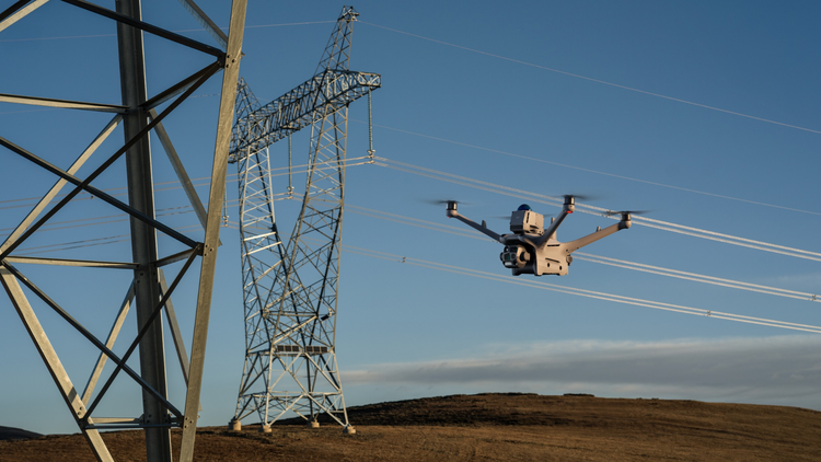
Aerial technology provides
practical ways to gather
visual and spatial information
from existing infrastructure
and proposed installations.
High-resolution imagery can
document antenna panels,
microwave dishes, remote
radio units, connections
and associated equipment.
Findings help engineers
investigate visible defects
and deterioration.
Examine accessible steelwork,
lattice structures,
mounting arms, brackets
and fixings for visible
corrosion, deformation
or damage requiring
specialist assessment.
Capture aerial views
from suitable positions
near proposed antenna
locations to assess terrain,
vegetation, buildings
and potential obstructions
along a communications path.
Aerial imagery and
suitable geospatial data
can support consideration
of mounting locations,
mast heights,
nearby obstacles and
site access for proposed
installations.
Photographs and appropriate
3D models can document
visible equipment positions,
antenna configurations
and supporting structures
for engineering records.
Drone observations can
support maintenance
preparation, equipment
replacement planning and
post-installation visual
checks before deploying
specialist resources.
From Flight to Engineering Assessment
Whether inspecting an
existing mast or assessing
a proposed wireless link,
a structured survey ensures
the information collected
is relevant to the
engineering objective.
Establish the inspection
scope or proposed link,
site permissions,
operating restrictions
and required outputs.
Collect aerial imagery
and appropriate positional
information from planned
survey viewpoints.
Organise observations
and provide relevant
information for
competent engineering
personnel to evaluate.
|
Line of Sight Surveys.
|
What does a Line of Sight Survey assess?
|
|
Inspection detail
|
Optical Zoom Cameras Provide detailed visual inspections of elevated antennas, mounting systems and communications equipment.
Aerial Line of Sight Surveys Capture views along proposed wireless communications paths to identify visible obstructions.
Photogrammetry & Site Models Create models of visible structures and surrounding environments for engineering visualisation.
Mapping & Elevation Data Suitable survey data can inform assessment of terrain, building heights and proposed antenna positions. |
Why It Matters
Drone technology can
complement existing
telecommunications
engineering processes
by improving access
to visual and spatial
information.
Obtain initial visual
information about elevated
components before determining
whether engineers need
to access the structure.
Review proposed communications
viewpoints and visible obstacles
before proceeding with
specialist design or installation.
Document equipment arrangements,
site conditions and installation
changes for communication
between technical teams.
|
A successful survey
|
What should organisations consider?
What is the survey objective?
Define whether the
What site information is available?
Provide antenna locations,
What restrictions apply?
Confirm access,
What engineering review is required?
Determine whether |
|
A clearer view
|
Iprosurv can support |
Whatever you need drones to do, there are three ways to work with Iprosurv.
Our pilots carry out the survey or inspection and deliver the data and reports you need.
Accredited courses that give you and your team the skills to fly safely and legally.
The drones, sensors and software to run your own operations, with expert advice.
Tell us what you are trying to achieve and we will recommend the right service, training or equipment.