Bridges & Civil Infrastructure Inspections
Infrastructure & Utilities | Bridges & Civil Infrastructure Inspecting the structures that keep Britain connected.…
|
The Challenge
A changing site needs an accurate and up-to-date picture.
|
Questions That Matter
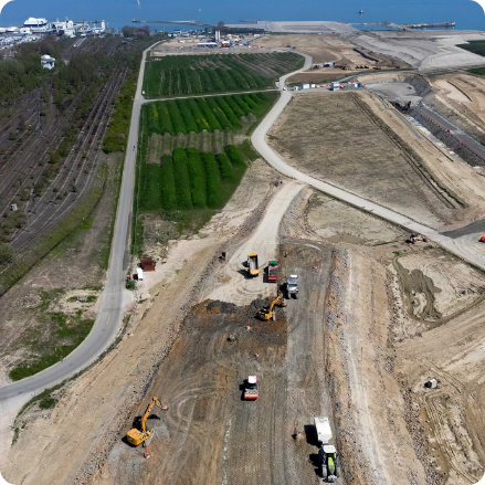
What does the site look like today?
Produce current aerial mapping and digital terrain information for planning and coordination.
How has excavation progressed?
Compare suitable survey datasets to document changing excavation boundaries and ground levels.
Are access routes changing?
Map haul roads, site infrastructure and terrain features relevant to operations.
Can records support future planning?
Maintain dated geospatial information for engineering, restoration and operational review. |
Drone Mapping Applications
Aerial mapping provides site-wide information for planning, documentation, engineering analysis and change monitoring throughout the operational lifecycle.
|
01 / Topographical Surveys
Quarry & Mine Site MappingProduce orthomosaics, point clouds and suitable terrain or surface models to document site layout, elevation, excavation features and infrastructure. |
02 / Excavation Monitoring
Excavation & Extraction ProgressCompare repeat survey records to document working-area development, extraction boundaries and changes in excavation geometry. |
|
03 / Operational Layout
Haul Roads & Site InfrastructureMap access roads, ramps, processing facilities, drainage routes and site boundaries to support operational planning and documentation. |
04 / Bench Geometry
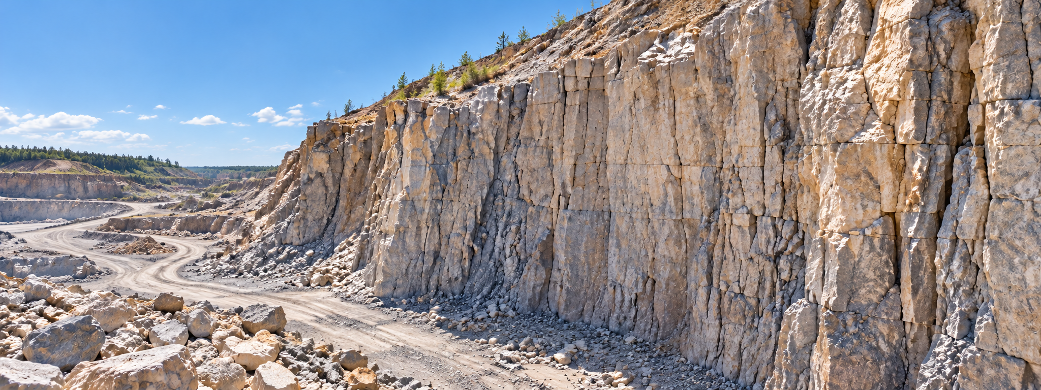
Benches, Slopes & Working FacesCapture suitable spatial data describing bench locations, slope geometry and exposed faces to support qualified geotechnical and mine-planning specialists. |
|
05 / Digital Modelling
3D Site Models & Digital TwinsCreate visual and geospatial representations of the site that can support engineering discussions, project planning and integration into suitable digital workflows. |
06 / Site Restoration
Restoration & Rehabilitation MappingDocument landform changes, restoration areas, drainage features and ground levels as extraction areas are rehabilitated or repurposed. |
|
07 / Land & Environment
Drainage, Terrain & Surface FeaturesCapture terrain and site features to assist specialists reviewing surface water routes, erosion concerns and wider ground conditions. |
08 / Asset Records
Repeat Mapping & Change DetectionMaintain comparable georeferenced site records that help teams understand how the quarry or mine has changed between survey dates. |
From Survey to Site Intelligence
High-quality mapping requires careful mission planning, appropriate control and positioning methods, reliable data capture and suitable processing and quality checks.
|
01. Plan & Control Agree survey boundaries, coordinate system, required accuracy, ground control, access and operational safety arrangements. |
02. Capture & Process Collect suitable overlapping photographs or LiDAR data, then process imagery and observations into spatial datasets. |
03. Validate & Deliver Check relevant accuracy and coverage requirements before supplying suitable mapping, models and other agreed deliverables. |
|
Technology in Action
Photogrammetry and LiDAR reveal different parts of the same landscape.
|
Mapping Technology Explained
Photogrammetry
High-resolution overlapping imagery for mapping and three-dimensional modelling.
Laser Scanning
Dense geospatial point clouds representing measured surfaces and terrain features.
Survey Positioning
Positioning and ground-control workflows supporting accurate georeferencing.
Terrain & Surface Models
Digital representations of the landscape and operational features.
Geospatial Deliverables
Orthomosaics, point clouds and compatible spatial data for specialist workflows. |
Practical Survey Deliverables
The value of drone mapping is not simply the flight or the resulting photographs. It is the delivery of useful spatial information in formats that fit the client’s planning and operational needs.
|
01 / Visual Records
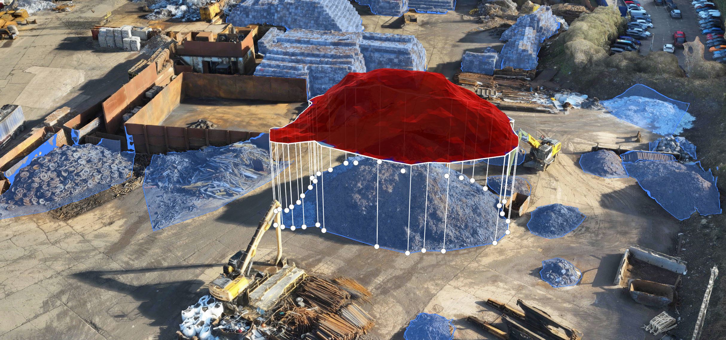
Orthomosaics & Site ImageryGeoreferenced aerial photographs provide a detailed visual overview of the surveyed site and its operational features. |
02 / Spatial Data
Point Clouds & Digital ModelsSuitable three-dimensional datasets can support terrain analysis, site visualisation and further specialist processing. |
03 / Engineering Workflows
GIS & CAD-Compatible OutputsAgreed file formats can support integration into compatible engineering, surveying and geospatial software. |
Define the deliverables before flying:
Coordinate system, required accuracy, resolution, coverage, model type and output format should be established in advance. This helps avoid collecting attractive imagery that cannot meet the client’s actual survey requirements.
Why It Matters
Professionally planned drone surveys can improve the way quarry and mine operators document their site and understand changes over time.
Support Operational PlanningCurrent mapping and terrain information help teams review working areas, infrastructure and site development. |
Reduce Unnecessary Site AccessRemote data collection may reduce some survey personnel exposure in difficult terrain and active operational areas. |
Maintain Comparable RecordsRepeat surveys provide dated datasets to support comparisons, reporting and long-term site documentation. |
|
Planning Quarry & Mine Mapping
Good mapping begins with a clear survey specification.
|
Planning Considerations What should quarry operators consider?
What needs mapping?
Whole site, excavation areas, roads, benches, drainage or restoration areas.
What accuracy is required?
Set realistic specifications and suitable quality-control methods.
How will the survey be used?
Planning, engineering, progress monitoring, visualisation or asset records.
How often is updated data needed?
One-off survey, periodic updates or a structured change-monitoring programme.
Which formats are required?
Orthomosaics, point clouds, terrain models and compatible GIS or CAD files. |
Whatever you need drones to do, there are three ways to work with Iprosurv.
Our pilots carry out the survey or inspection and deliver the data and reports you need.
Accredited courses that give you and your team the skills to fly safely and legally.
The drones, sensors and software to run your own operations, with expert advice.
Tell us what you are trying to achieve and we will recommend the right service, training or equipment.