Co-Funded CAA Drone Training with at Least 50% Funding Support in Eligible Areas
CAA-recognised drone training with practical flight sessions, mapping, and hands-on access to multiple platforms. Open to organisations and individuals in eligible regions.
Build practical drone capability with co-funded training
Drone technology is now being used across a wide range of sectors to improve data capture, inspections, surveying, mapping, planning, asset management, reporting, and operational visibility.
From housing and local authorities to engineering, estates, land management, infrastructure, education, environmental services, and commercial organisations, more teams are recognising the value of building in-house drone capability.
To support that growth, we are offering co-funded drone training in eligible areas shown on the map in green, with at least 50% of course costs covered.
This means delegates can access specialist training with a minimum saving of £650 per person, with a typical employer or delegate contribution of £650 + VAT.
Open to a broad range of sectors and learners, this opportunity is not limited to one industry.
The funding is open to eligible learners and organisations across a broad range of sectors, including:
- Local authorities
- Housing associations and housing providers
- Asset and facilities management teams
- Surveying and inspection professionals
- Civil engineering and infrastructure teams
- Construction and earthworks businesses
- Environmental and land management organisations
- Utilities and service providers
- Education and training providers
- Planning and development professionals
- Estates and property teams
- Individuals looking to develop new technical skills
Whether the goal is to improve inspections, capture better site information, support asset records, monitor change over time, or explore new digital workflows, this training provides a practical route into drone operations and drone-enabled data capture.
What the training includes
This programme is designed to give learners both recognised qualifications and practical confidence.
It includes:
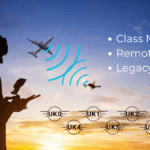
- CAA-recognised A2 CofC and GVC training
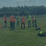
- 4 days of theory and practical flying sessions
- An additional 2 days focused on mapping
- Hands-on experience with multiple drone platforms
- Operational understanding of drone workflows
- Exposure to software, planning, and data capture processes
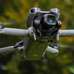
- Access to a range of equipment from DJI Mini 5 – DJI Matrice 4E/4T/4DT, DJI Matrice 400 with L3 LiDAR and P1 sensors
This combination helps learners move beyond basic flight knowledge and better understand how drones can be used to support real operational outcomes.
No drone purchase required
Delegates do not need to own a drone to attend.
All drones are provided during the training, allowing learners to gain experience on a range of platforms before making any purchasing decisions. This is especially valuable for organisations that want to explore capability first, understand what is fit for purpose, and avoid spending money on the wrong equipment.
It also makes the programme accessible to those who are at an early stage of adoption and want to learn before investing.
Why organisations are investing in drone capability
Drone training is not simply about flying. It is about understanding how to use drone technology safely, effectively, and productively.
Depending on the organisation, drone capability can support:
- visual inspections
- mapping and surveying
- asset monitoring
- roof and property assessments
- land and estate management
- project progress reporting
- environmental observation
- safer access to hard-to-reach areas
- more accurate and up-to-date visual records
- improved planning and decision-making
For many organisations, the real benefit lies in being able to collect better information, more efficiently, with greater consistency and reduced risk.
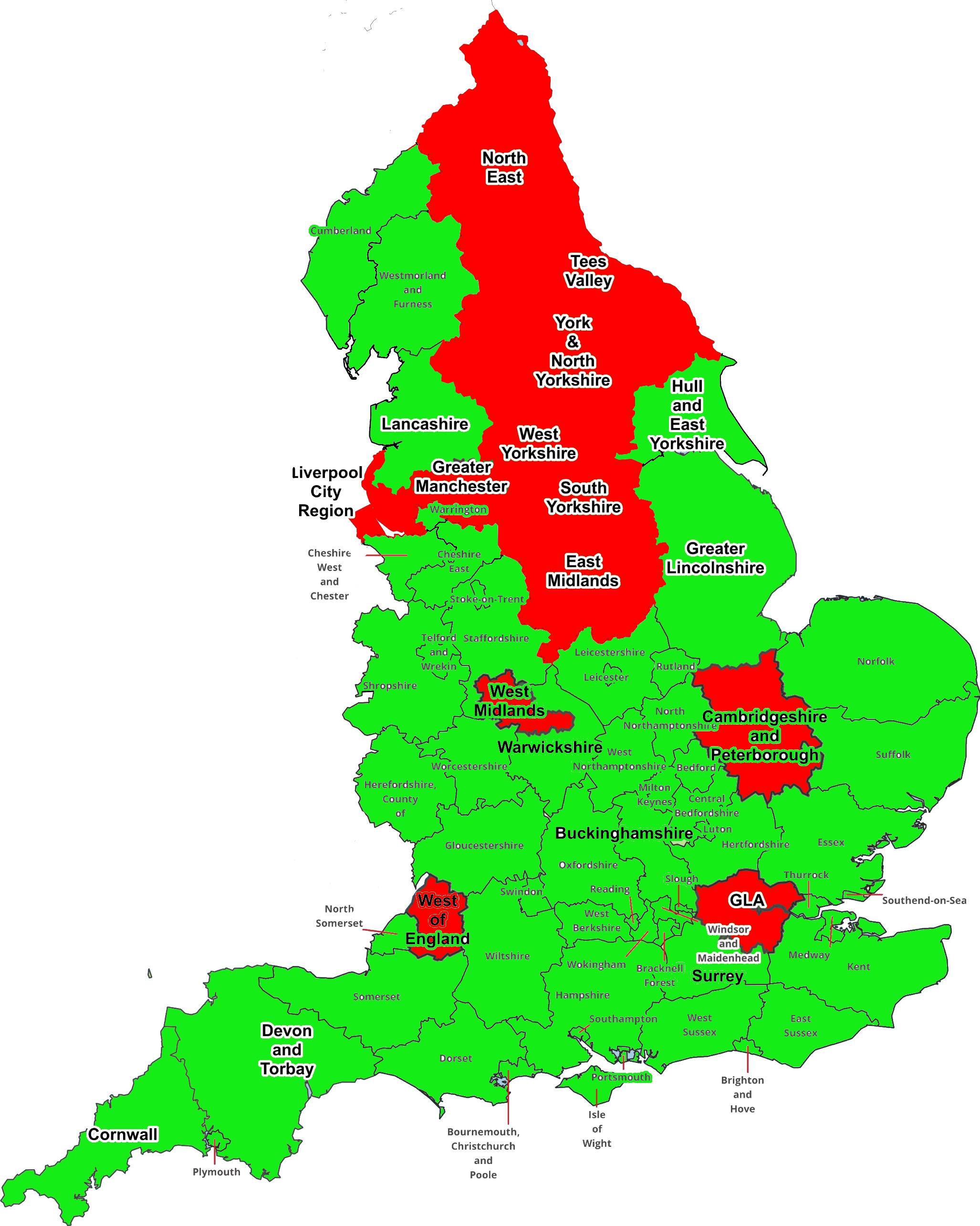
Co-funded support in eligible regions
Organisations and learners based in the green areas shown on the map may be eligible for at least 50% co-funding toward this programme.
This creates a valuable opportunity to build new skills, test capability, and increase internal knowledge without paying the full cost of training.
If you are located in one of the eligible areas, now is the time to explore what support may be available.
Learner feedback
One recent learner shared:
“The course was extremely valuable for our team. It not only met the qualifications we needed but also provided practical insights into software, mapping, and flight planning. Being able to use different drone platforms before making any purchasing decisions was a major advantage. We came away with a far better understanding of how drone data can support our projects accurately and efficiently.”
Book a free consultation call or discovery day
If you are interested in how drones could support your organisation, team, or future plans, we are currently offering a free consultation call or discovery day to help you explore whether this training is right for you.
We can help you understand:
- Whether your location is eligible for co-funding
- Which learners may benefit most
- How drone capability could apply to your work
- What qualifications are included
- What types of platforms may be suitable
- How to avoid investing in the wrong equipment too early
Get in touch today to find out more about co-funded drone training in your area.
Frequently Asked Questions
The funding is open to eligible learners and organisations in the covered regions, across a wide range of sectors including local authorities, housing, surveying, engineering, estates, infrastructure, education, and commercial organisations.
Eligible applicants in the covered areas can access at least 50% co-funding, giving a minimum saving of £650 per delegate.
The programme includes CAA-recognised A2 CofC and GVC training, plus practical sessions and additional mapping training.
The course includes 4 days of theory and practical sessions, with an additional 3 days focused on mapping.
No. All drones are provided during the training.
It is suitable for organisations and individuals looking to build drone knowledge for inspections, mapping, surveying, reporting, estate management, property assessment, environmental work, infrastructure support, and other operational uses.
It helps learners build confidence, gain recognised qualifications, understand safe drone operations, and explore how drone data can support real-world decision-making.