
Introduction
Drones have emerged as transformative tools in the realm of insurance and risk surveys, offering unprecedented advantages both before and after significant events.
Pre-event, these unmanned aerial vehicles provide insurers with a cost-effective and efficient means of assessing risks by conducting thorough aerial surveys. The ability to capture high-resolution images and data allows for a comprehensive understanding of the landscape, enabling insurers to make more informed underwriting decisions.
Post-event, drones play a crucial role in expediting the claims process by rapidly assessing damage in hard-to-reach or hazardous areas. Their agility and versatility enable swift response times, facilitating quicker claims settlements and reducing overall financial losses.
In essence, the integration of drones into insurance workflows enhances overall risk management strategies, making the industry more resilient and responsive to the dynamic challenges it faces.
Post Incident Desktop Inspection Reporting
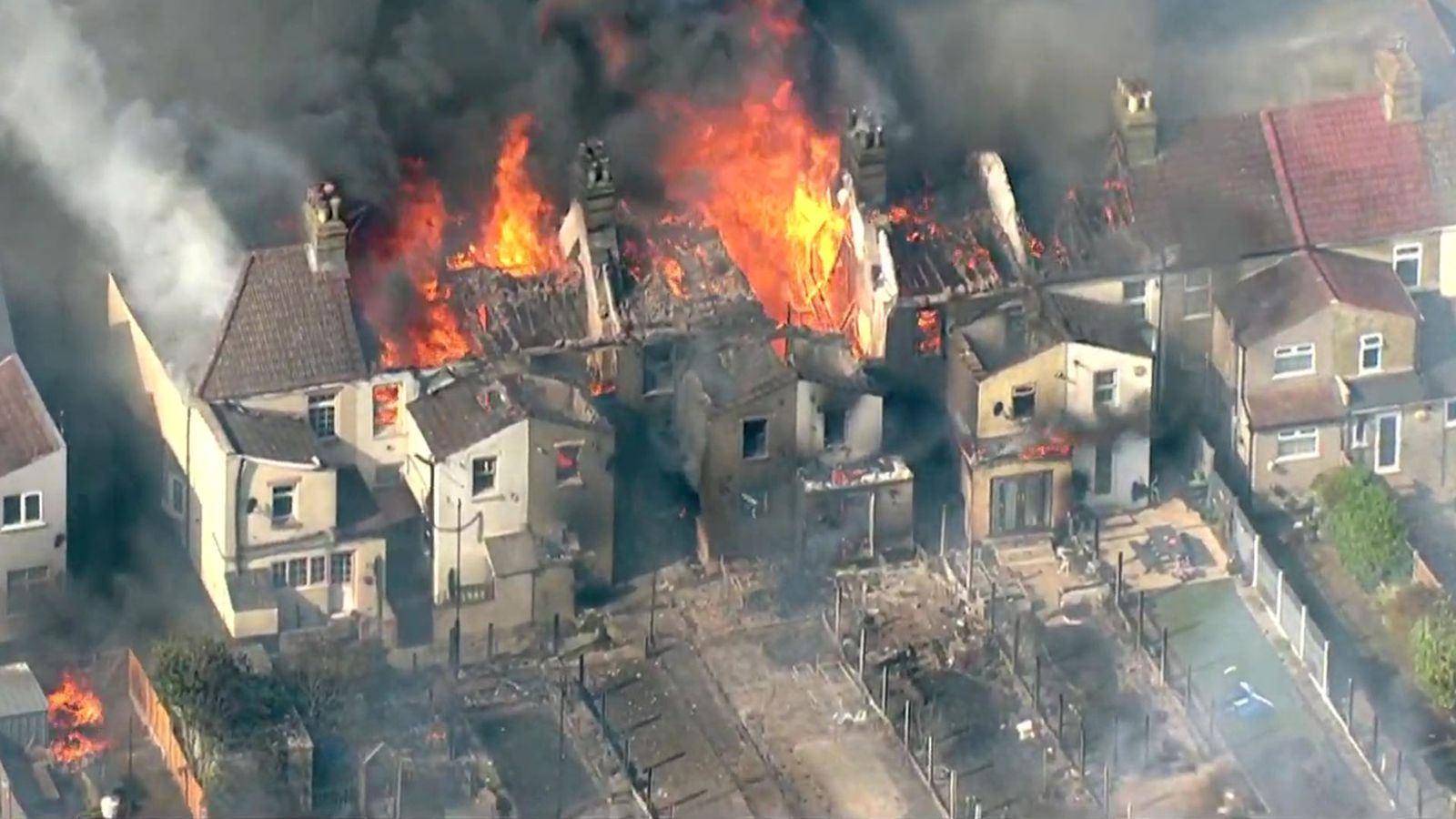
In the aftermath of natural disasters such as fires, floods, and storms, drones have emerged as invaluable tools for efficient and comprehensive post-event data collection. Rapid deployment of drones allows for swift assessment of damage, aiding in the quick allocation of resources and formulation of effective response strategies.
Drones provide a versatile platform capable of capturing not only images and videos but also generating 3D measurable interactive models. This wealth of data serves multiple investigations involving various stakeholders, facilitating a streamlined and collaborative approach to disaster recovery.
By producing white-labeled reports, drones contribute to clear and accessible documentation, enhancing communication among relief organizations, insurers, and government agencies.
Additionally, their ability to access large and inaccessible areas ensures a more thorough evaluation of the affected regions, enabling timely decision-making and targeted intervention efforts. Ultimately, the integration of drones in post-disaster scenarios transforms data collection into a powerful tool for expedited damage assessment and coordinated recovery efforts.

Multi Storey Inspections
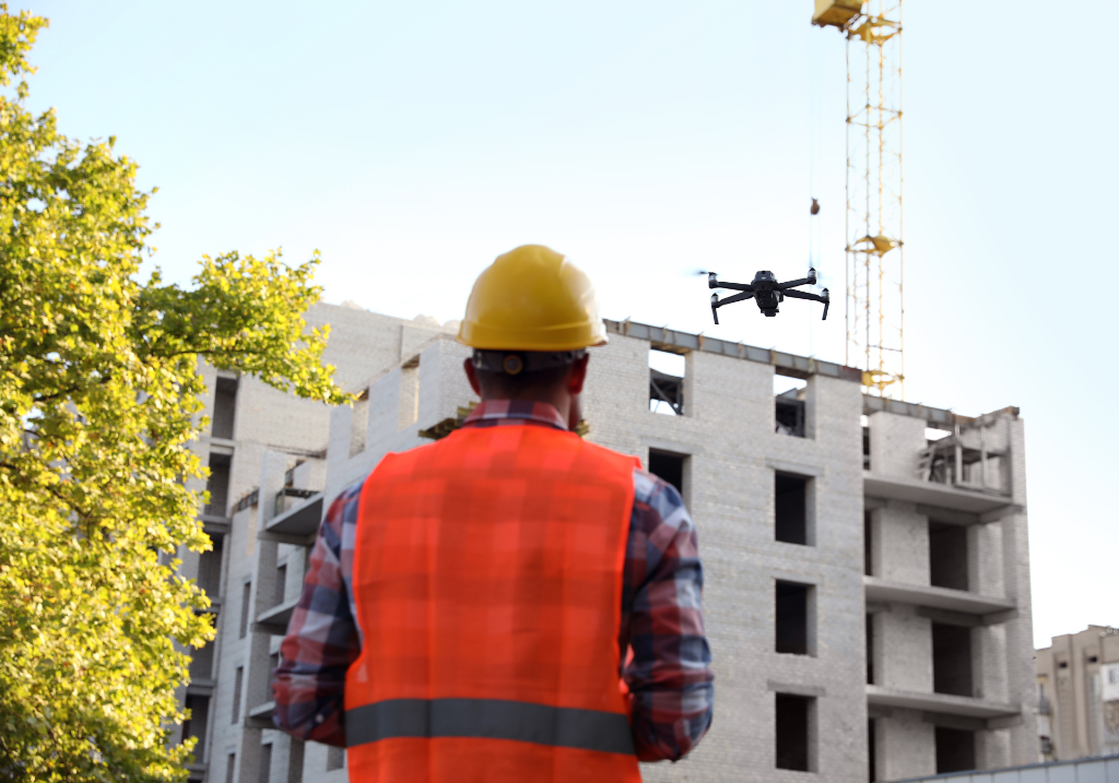
Unmanned Aerial Vehicles (UAVs), commonly known as drones, have significantly transformed the landscape of multi-storey asset inspections, especially in light of complexities presented by residential high-rises grappling with external cladding wall insulation failures, exemplified by the tragic Grenfell incident.
Drones provide distinct advantages in these settings, offering rapid deployment that drastically minimizes inspection durations. This efficiency enables the acquisition of essential data in mere fractions of the time required by conventional methodologies. UAVs are particularly adept at generating intricate 3D models that are crucial for the precise identification of defects such as cladding failures.
Furthermore, the financial implications of employing drone technology for building inspections are substantial, presenting a cost reduction of approximately 90% compared to traditional access techniques. This affordability makes UAV inspections an economically attractive alternative. Additionally, drones support contemporary environmental sustainability goals, promoting an eco-friendly approach to building management.
From a client perspective, the use of drones facilitates expedited and more accurate decision-making processes, thereby enhancing operational efficiency. Drones also streamline the inspection processes across multiple assets, enabling thorough and comprehensive evaluations.
Ultimately, drones stand out as a critical technological innovation, adeptly addressing the challenges associated with the inspections of multi-storey assets through enhanced efficiency, cost-effectiveness, and a commitment to environmental sustainability.
Agricultural Damage
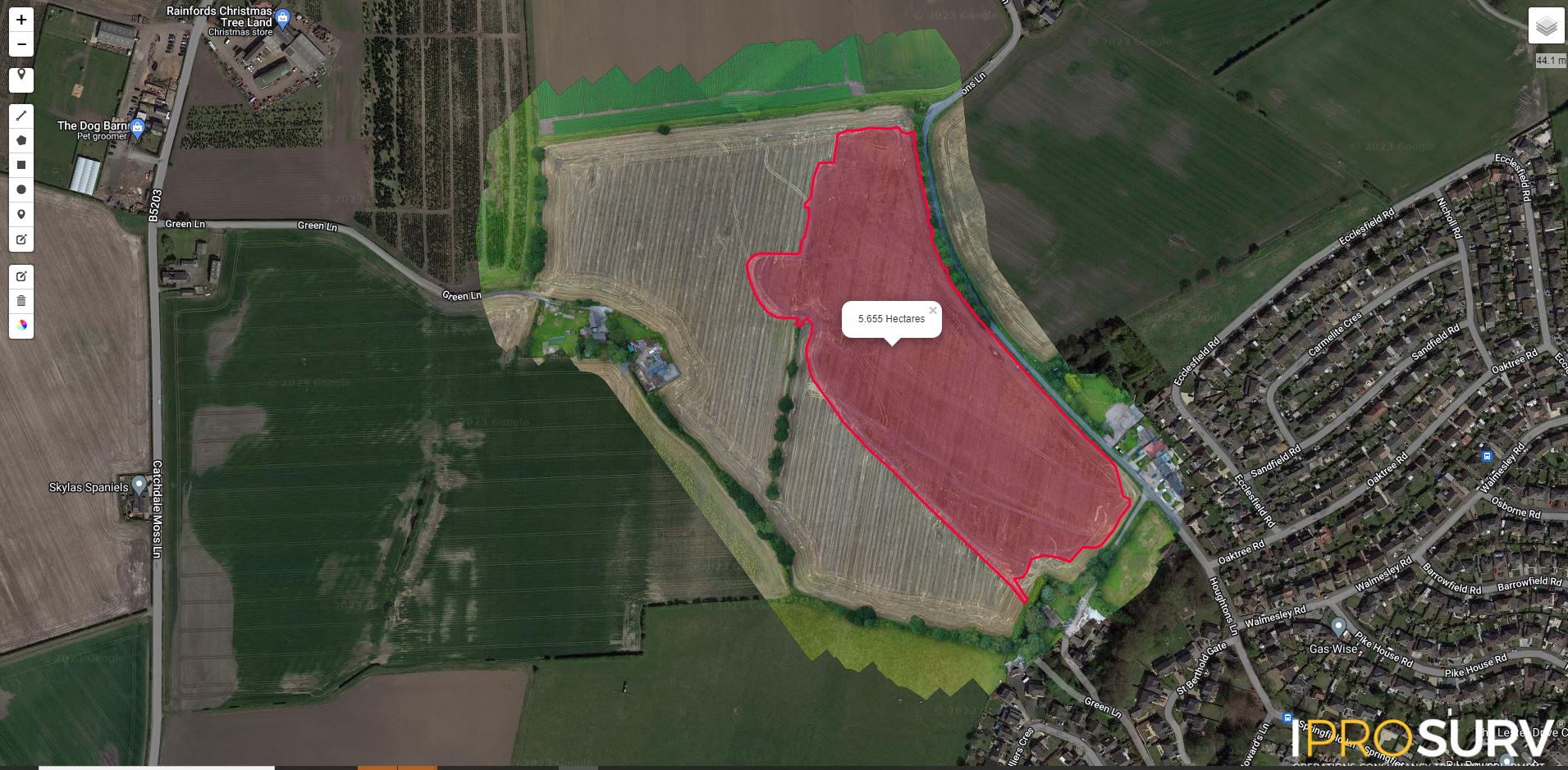
Drones have transformed the agricultural industry by providing fast, efficient solutions to critical challenges, particularly in the aftermath of fire damage or seed drill failures. In times of crisis, drones equipped with cutting-edge mapping technology can swiftly survey affected areas, producing detailed, interactive maps that accurately assess the extent of the damage.
This rapid response allows insurers to quickly allocate reserves and expedite claim settlements, giving farmers the financial support they need to replant and recover their crops, ultimately securing their livelihoods. Additionally, drones with specialized multispectral imaging capabilities are instrumental in detecting crop diseases and irrigation issues, leading to enhanced crop yield optimization.
These advanced devices also identify spray drift and locate areas that could pose risks to crops, enabling precise, targeted interventions that address agricultural challenges while promoting sustainable farming practices.
Post Works Inspections
Drones have transformed post-works inspections by offering a fast and effective solution to identify workmanship issues, address complaints, and evaluate recovery efforts. Their ability to navigate diverse terrains and capture high-resolution images allows for comprehensive assessments of completed projects, enabling real-time progress monitoring through intermediate inspections.
This approach ensures that projects remain on schedule and facilitates early detection of deviations from the planned timeline. Integrating drones into inspection processes at the point of claim and post-works not only streamlines project evaluation but also creates a valuable historical dataset.
This dataset serves as a critical resource for quickly identifying and resolving recurring issues. Additionally, drones enhance supply chain management by providing real-time insights into the production and distribution processes, leading to more accurate cost estimations and optimized resource allocation.
This proactive approach to quality control and issue resolution in construction and maintenance projects is further strengthened by the dynamic, data-rich insights drones provide, elevating both immediate issue resolution and long-term project management strategies.