Topographical Surveys & Earthworks Mapping
Construction & Built Environment | Topographical Surveys & Earthworks Mapping Understand the ground before you…
Construction projects involve
contractors, engineers, surveyors,
project managers, clients and
commercial teams, often working
from different locations and
relying on information captured
at different times.
Traditional site reports,
photographs and drawings remain
important, but they can be difficult
to compare. A photograph records
one viewpoint; a drawing shows
intended design; a site diary
documents activities. None
necessarily provides a complete
spatial record of what has
actually been built.
Repeatable drone surveys bring
these observations into a
shared visual environment.
Orthomosaic maps, 3D models
and dated inspection records
make it easier to understand
changes, examine apparent
differences and communicate
progress across the project.
Compare surveyed terrain
and earthworks against the
intended formation and design levels.
Review dated site records
against programme milestones
and reported work completion.
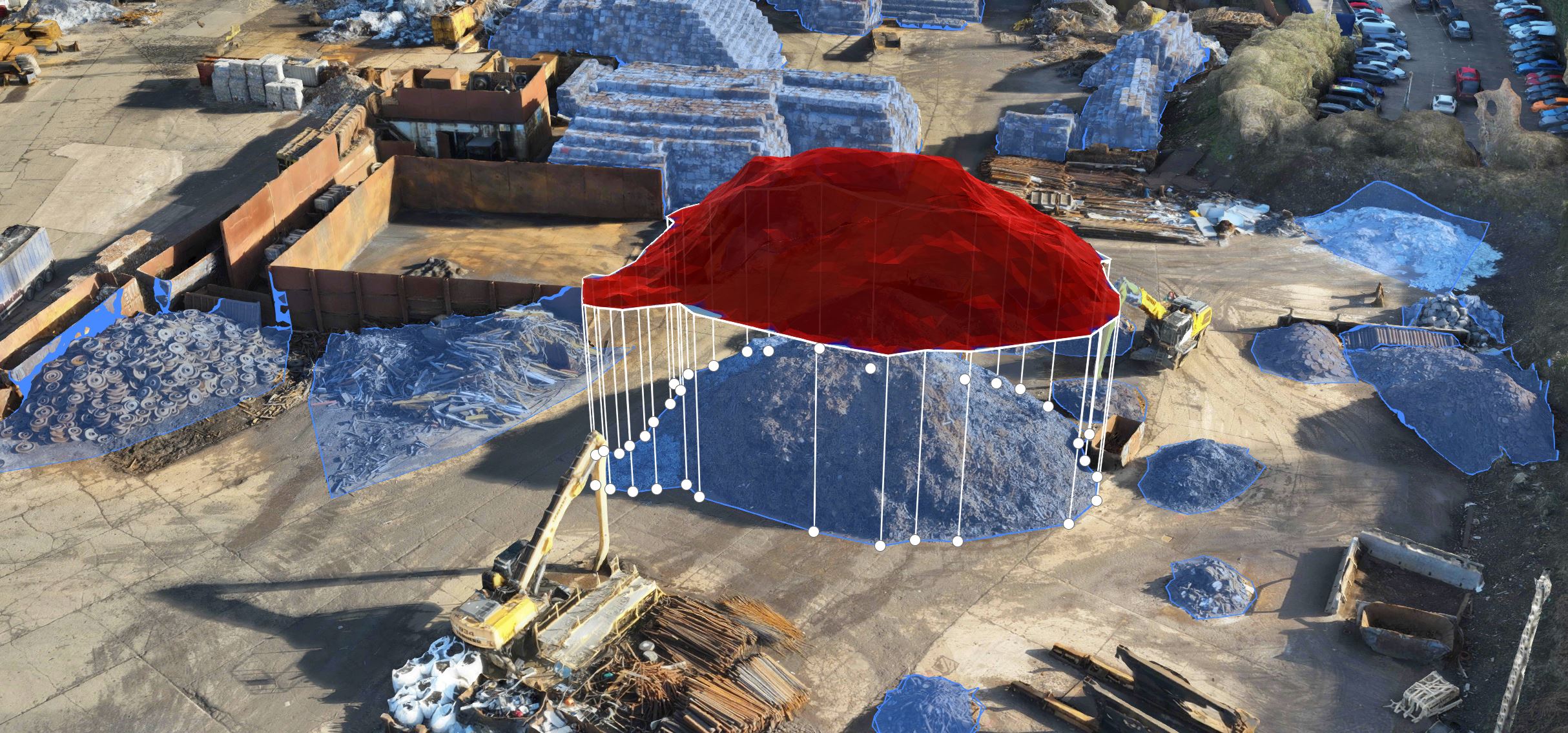
Assess visible stockpiles,
material storage areas
and changes in site logistics.
Retain the construction history,
including accessible details
that may become concealed later.
Drone Applications
Drone monitoring can be incorporated
throughout the construction programme,
delivering different information
as the site moves from initial
preparation through to handover.
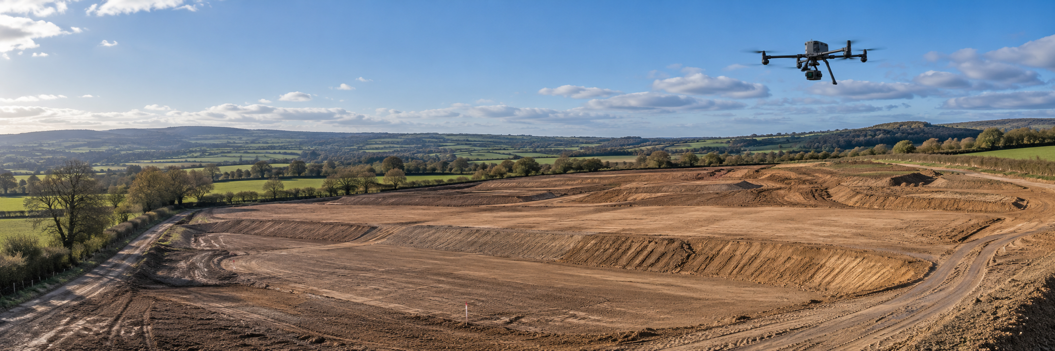
Establish an initial topographical
record before major works commence.
Subsequent drone surveys can
measure excavation volumes,
embankments, site formation levels
and cut-and-fill quantities when
appropriate survey controls
and reference surfaces are used.
This supports earthworks planning,
material movements and verification
of measured progress.
Capture foundations, structural
development, roof installation,
external works and emerging
infrastructure at regular intervals.
Comparable orthomosaics,
photographs and 3D models help
project teams examine progress,
identify visible discrepancies
and document the sequence
of construction.
Drone surveys can document
aggregate stockpiles, spoil heaps,
delivery areas, storage zones
and vehicle routes. Measured
stockpile volumes and site
overview imagery can support
material planning, inventory
reconciliation and decisions
about how available working
space is being used.
Aerial views can support
scheduled reviews of access
routes, perimeter condition,
housekeeping, stored materials
and the separation of work areas.
They can also document visible
site conditions following an
incident. These observations
complement, rather than replace,
competent health and safety
inspections and physical
security arrangements.
From Ground Survey to Digital Record
The greatest value comes from
treating drone monitoring as an
organised information programme,
rather than collecting individual
aerial photographs whenever
an update is requested.
Complete the initial site
survey, confirm the coordinate
system and survey control,
and capture existing
terrain and site conditions
before construction changes them.
Fly planned missions at
agreed intervals or milestones,
creating dated orthomosaics,
3D models and inspection
imagery that can be compared
with earlier datasets.
Organise each survey alongside
relevant design, programme
and inspection information,
giving stakeholders access
to a cumulative digital
record of the development.
Technology in Action
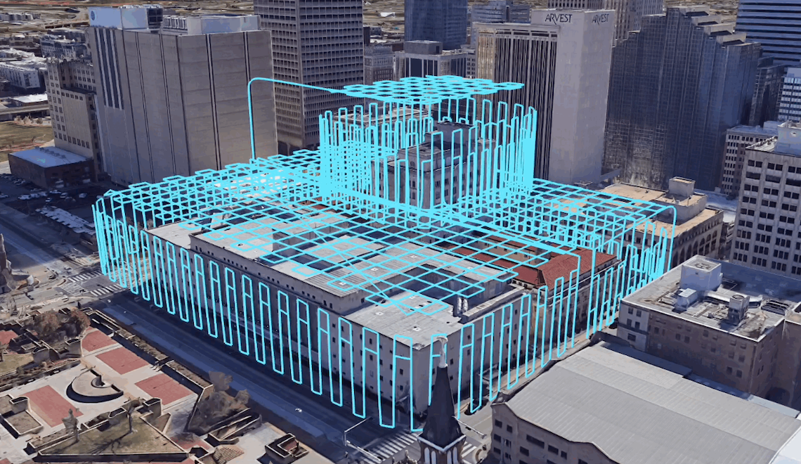
A single drone survey provides
a record of the site at a
particular moment. When
repeated throughout construction,
these surveys create a
chronological picture of
the developing project.
Design versus reality:
Surveyed ground levels and
modelled visible features
can be compared with design
information to identify
differences that require
engineering review.
Progress versus programme:
Dated models and aerial images
help stakeholders see which
work areas have visibly advanced.
Linking this to programme
milestones provides useful
context for identifying potential
delays and supporting decisions.
Documenting concealed work:
Capturing foundations, drainage
trenches and structural stages
before they are covered can
create valuable visual references
for later investigation. Drone
records must be supplemented
by the required inspections
and certified as-built information.
The digital twin:
When dated 3D models are linked
with design data, construction
records, asset information
and relevant operational updates,
they can form part of an
integrated digital twin.
The result can be more than
a visual history: a structured
information resource supporting
project decisions, handover
and future asset management.
Why It Matters
Measured earthworks, stockpile
volumes and documented progress
can provide supporting evidence
for quantity reviews, budget
discussions, valuation assessments
and the early investigation
of differences between planned
and actual work.
Clients, contractors, engineers
and project managers can review
consistent dated imagery and
models instead of relying
solely on separate reports.
This supports remote oversight,
coordination meetings and
more informed decisions.
A chronological archive can
show how the site developed
from initial earthworks to
final completion. With suitable
records and integration, it can
provide useful reference
information for facilities teams,
maintenance planning and
future alterations.
Introducing Drone Technology
Capturing construction progress
successfully requires more
than arranging an occasional
drone visit. The survey programme
needs to match the questions
that project teams want answered.
Survey consistency:
Comparable surveys benefit
from agreed coordinate systems,
survey control, capture methods,
repeatable viewpoints and
appropriately validated
positional accuracy.
Survey frequency:
Weekly, fortnightly or
milestone-based visits can
be selected around construction
activity. Groundworks may
require more frequent
measurement than periods
of limited external change.
Site operations:
Cranes, temporary structures,
moving plant, site personnel
and restricted airspace must
be considered when planning
drone flights. Safe access,
operational authorisations
and site coordination remain
essential.
Data governance:
A valuable long-term record
needs clear file naming,
dates, access permissions,
storage arrangements and
retention of source data
where appropriate.
Safety and security:
Drone imagery may help identify
visible hazards or security
concerns, but does not replace
site inspections, security patrols
or legal responsibilities.
Privacy and confidentiality
must also be considered.
Digital twin development:
A series of 3D models alone
is not a fully integrated
digital twin. The necessary
links to BIM, asset registers
and ongoing information
management must be planned
and maintained.
Define whether the priority
is earthworks verification,
schedule reporting,
cost control, materials,
safety oversight or
digital asset management.
Agree a practical survey
schedule aligned with
significant construction
stages and reporting needs.
Consider orthomosaics,
3D models, point clouds,
elevation data, cut-and-fill
reports, stockpile measurements
and dated inspection images.
Decide how clients,
contractors, surveyors
and engineering teams
will review and share
the information securely.
Establish ownership,
data formats, retention,
BIM integration and
the information future
asset managers will need.
Whatever you need drones to do, there are three ways to work with Iprosurv.
Our pilots carry out the survey or inspection and deliver the data and reports you need.
Accredited courses that give you and your team the skills to fly safely and legally.
The drones, sensors and software to run your own operations, with expert advice.
Tell us what you are trying to achieve and we will recommend the right service, training or equipment.