Expert Drone Surveys for Post-Storm Windblown Forestry
When devastating storms like Storm Arwen wreak havoc on forestry, assessing damage and planning recovery can be daunting.
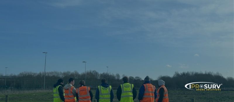
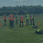
At Iprosurv, we specialize in post-storm inspections of windblown forestry, helping landowners and forestry managers navigate these challenging times. With extensive experience surveying hundreds of acres of damaged forestry, including after Storm Arwen, we deliver the actionable data you need to move forward confidently.
Supporting Forestry Recovery After Storm Arwen
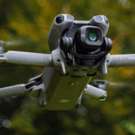
In November 2021, Storm Arwen caused widespread devastation, felling over 8 million trees and damaging thousands of hectares of forestry across the UK. Iprosurv responded by deploying advanced drone technology to assist forestry managers with detailed inspections and recovery planning.
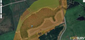
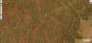
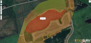
Our drone surveys allowed us to create precise, measurable orthomosaic maps of windblown forestry, giving clients the data required to apply for felling permissions. This was a critical step in clearing damaged areas and initiating replanting efforts. By enabling forestry managers to assess the damage quickly and accurately, Iprosurv helped restore these forests more efficiently while maintaining the highest safety standards for all involved.
The Advantages of Using Drones in Windblown Forestry
Drones offer significant benefits when dealing with the aftermath of storms and windblown forestry:
1. Drones Cover Large Areas Quickly
When storms like Arwen impact thousands of hectares of forestry, time is of the essence. Drones can survey large areas in a fraction of the time required by traditional ground-based methods, ensuring forestry managers have the critical information they need to act swiftly.
2. Drones Make the Inaccessible Accessible
Windblown forestry areas are often difficult and dangerous to access due to uneven terrain, fallen trees, and unstable ground. Drones can safely navigate these challenging environments, capturing high-resolution imagery and data that would otherwise be impossible to gather.
3. Enhanced Health and Safety
Windblown forestry presents life-threatening risks to personnel, with partially fallen trees weighing over two tonnes and capable of falling at any moment. By eliminating the need for people to enter hazardous areas, drones ensure that inspections are conducted in the safest possible way.
4. Cost-Effective, Simple, and Repeatable
Drone surveys are a cost-effective alternative to traditional methods, reducing the need for large teams and expensive equipment. Drones also provide consistent, repeatable data collection, ensuring accuracy and reliability across multiple inspections.
Preparing for Storm Eowen
As Storm Eowen takes hold across the UK and Ireland, Iprosurv is prepared to support forestry managers and landowners in assessing and addressing any damage caused by the storm. With our national contractor network and proven expertise in post-storm inspections, we are ready to provide rapid, detailed surveys to help you understand the extent of damage and apply for necessary felling permissions.
Our drone technology is designed to deliver actionable insights, enabling you to prioritize tree removal, mitigate safety risks, and plan replanting efforts efficiently. With Iprosurv, you can trust that your forestry assets are in capable hands.
Contact Iprosurv Today
Don’t wait to assess the impact of storms on your forestry. Learn more about how we’ve helped others recover by viewing our windblown forestry case study.
To schedule an inspection or learn more about our services, contact us at info@iprosurv.com or call 0114 4055 007 to speak with a member of our team. Let Iprosurv help you protect and restore your forestry assets with our expert drone services.