Construction
“Using Iprosurv in our first project management solution for scoping works and timetables is definitely…
Any tip or stockpile where there is measurable movement is potentially unsafe. Appropriate procedures should be implemented immediately to determine the risk and required remedial action. This will involve immediate reappraisal or reassessment.
All excavations, tips and lagoons must be designed constructed and maintained to ensure stability and not place persons at risk to their safety and health. The control measures and inspection regime must be set out in the tips and stockpiles operating procedures. The inspection regime should include the data obtained from the design, normal operations, inspection, appraisal and assessment work.
In addition to the potential failure of a stockpile, tip or lagoon there are risks associated with the loading and unloading of tips and stockpiles presenting dangers to persons working below or operating vehicles in the area. Many incidents occur from rock falling off faces and from equipment falling off tips.
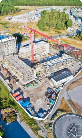
Using drones to enhance your workflow of construction sites, quarries, Stockpiles etc, can give quick and accurate measurements of volume, measurement, and value of stock. Drones are cost effective, repeatable, and reduce health and safety risks.
Not all drone service suppliers are the same Iprosurv have continually inovated within the drone market, which is reflected in our client base. Some of the advantages of using Iprosurv are: Full UK Coverage Proprietary software system with white label option and unlimited user access with self serve granular access permissions to users.
In the dynamic landscape of modern industrial operations, the integration of cutting-edge technologies has become paramount in optimizing efficiency, precision, and safety.
One such technological advancement that has revolutionized the mining and quarrying sector is the utilization of drone-based stockpile volumetric measurements and quarry inspections.
By harnessing the capabilities of unmanned aerial vehicles, industries can realize a multitude of benefits, ranging from enhanced accuracy and cost-effectiveness to improved personnel safety and regulatory compliance.
Amidst these advantages, adherence to crucial regulations such as The Quarries Regulations 1999 assumes a pivotal role, underscoring the symbiotic relationship between innovative methodologies and legal obligations in ensuring the holistic success of quarry operations.
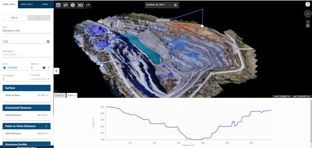
Incorporating cutting-edge drone technology into stockpile and quarry management, as well as safety inspections, presents a transformative solution with multifaceted advantages.
Leveraging the prowess of drones in conjunction with “The Quarries Regulations 1999” yields a paradigm shift in efficiency, accuracy, and safety across these critical domains.
By deploying drones for aerial surveys and volumetric analysis of stockpiles, companies can realize unparalleled precision in inventory management, significantly reducing operational costs and minimizing discrepancies. Moreover, drones enable swift and comprehensive safety inspections, mitigating the risks associated with manual assessments and enhancing compliance with regulatory frameworks like “The Quarries Regulations 1999.”
The real-time data acquisition capability of drones ensures timely identification and rectification of potential hazards, elevating workplace safety to new heights. Embracing drone technology not only streamlines operations and enhances productivity but also underscores a steadfast commitment to best practices and regulatory adherence, setting a new standard in responsible quarry management.
Drones, integrated with advanced sensors and GPS technology, yield meticulous measurements of stockpile volumes, ensuring a level of precision critical for strategic decision-making, aligned with the accuracy stipulated by “The Quarries Regulations 1999.”
Drone-enabled surveys expedite the coverage of expansive quarry areas and stockpiles, significantly curtailing the time required for inspections and measurements, thereby facilitating compliance with the time-efficient management practices advocated by “The Quarries Regulations 1999.”
Drones capture high-resolution imagery and intricate 3D models of quarries and stockpiles, bestowing comprehensive visual data instrumental in meticulous analysis, planning, and the nuanced interpretation that complements the regulatory requirement for thorough site assessments.
By streamlining inspection processes, mitigating labour expenditures, and diminishing the dependence on specialized equipment, drones align with the prudent resource management ethos encouraged by “The Quarries Regulations 1999.”
Drone deployment eliminates or minimizes the necessity for personnel to traverse hazardous terrains, mitigating risks associated with steep gradients or unstable surfaces, aligning inherently with the safety-centric ethos of “The Quarries Regulations 1999.”
Drones provide precise data for reporting, regulatory compliance, and comprehensive environmental assessments, ensuring seamless alignment with the reporting mandates and environmental considerations outlined in “The Quarries Regulations 1999.”
Drones afford consistent, scheduled inspections, empowering quarry management to discern alterations in stockpile dimensions and landscape morphology over time, a practice well-aligned with the proactive managerial approach advocated by “The Quarries Regulations 1999.”
Drone-derived data seamlessly integrates into diverse software ecosystems, including Geographical Information Systems (GIS) and inventory management platforms, facilitating streamlined data processing, analysis, and reporting.
The remote operability of drones facilitates the inspection and measurement of quarries situated in remote or challenging-to-access locations, effectively mitigating logistical complexities.
Drones’ non-intrusive aerial inspections and minimized site disturbance contribute to preserving local habitats and ecosystems, aligning with environmental conservation goals while adhering to safety standards and regulatory requirements.
Tell us about your project and we will come back to you with a quote.
We can train your team and supply the equipment.