Quarry & Mine Site Mapping
Mining, Quarrying & Confined Spaces | Site Mapping A clearer picture of your quarry, from…
|
The Challenge
Changing rock faces. Difficult access. Important safety decisions.
|
Questions That Matter
What is visible on the rock face?
Document accessible fractures, joint patterns, weathering and areas of visible deterioration.
How is the excavation changing?
Use suitable spatial datasets to compare exposed faces and bench geometry between surveys.
Can close access be reduced?
Gather visual observations remotely before planning detailed physical investigations.
What requires specialist examination?
Provide documented observations to qualified engineering and geotechnical teams. |
Drone Inspection Applications
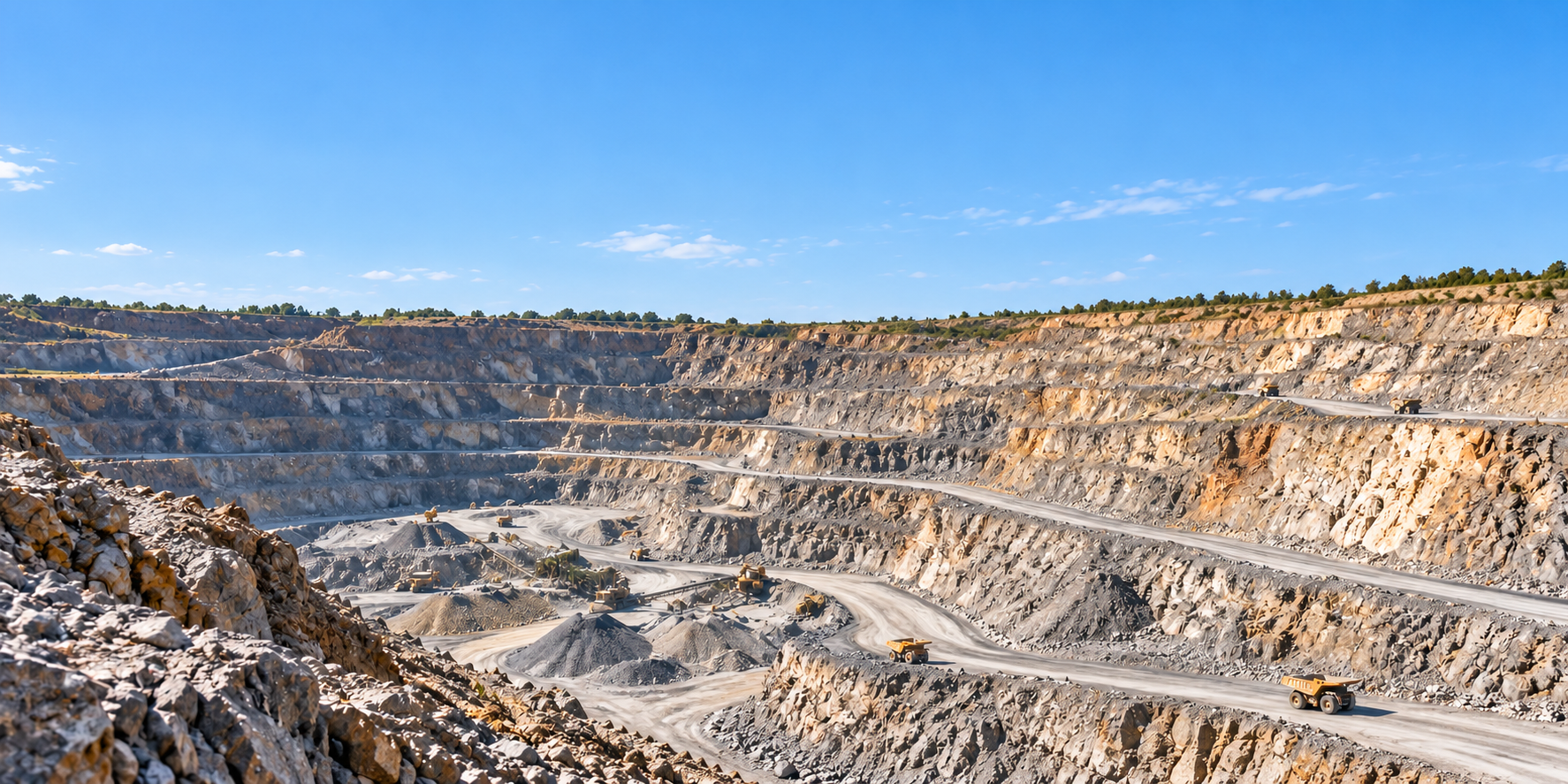
External quarry operations and enclosed underground workings require different drone platforms and operating methods, but both can benefit from appropriate visual and spatial records.
|
01 / External Highwalls
Quarry Highwall InspectionsUse suitable outdoor drones to document accessible highwall surfaces, fractures, rock features, weathering and visible changes from appropriately controlled stand-off positions. |
02 / Exposed Rock Faces
Rock Face Condition SurveysCollect high-resolution imagery of exposed faces, joint patterns, potentially loose material and other visible geological features for specialist interpretation. |
|
03 / Geospatial Analysis
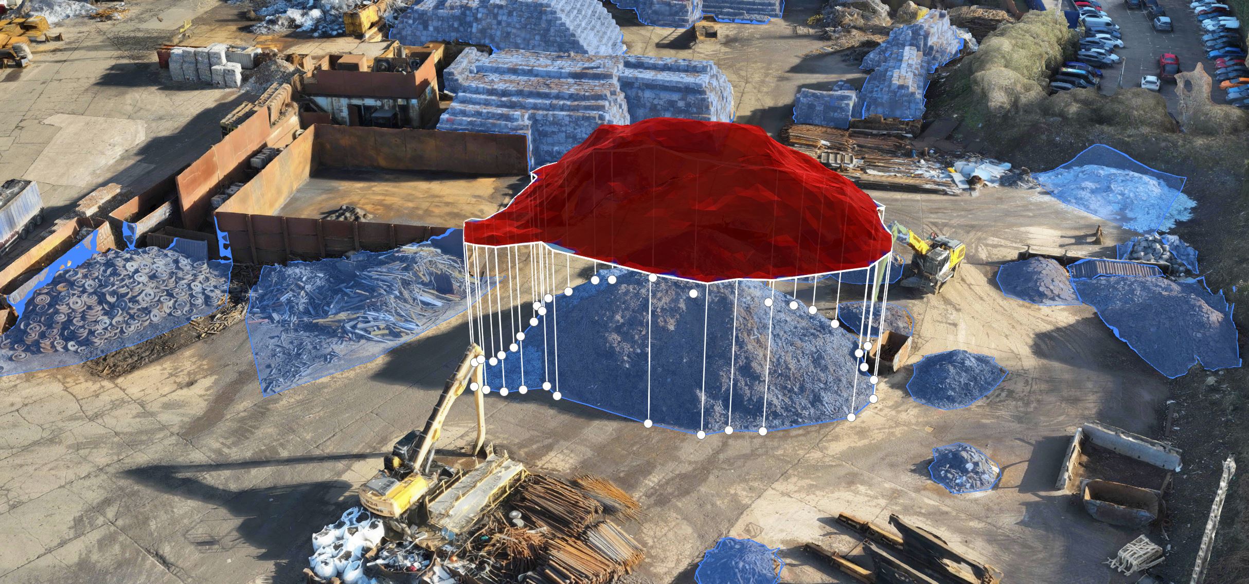
Photogrammetry & 3D Face ModelsProduce suitable three-dimensional representations of accessible rock faces to support documentation, geometry review and repeat comparisons. |
04 / Laser Surveying
LiDAR & Rock Face GeometryCapture spatial measurements of exposed rock surfaces where suitable LiDAR equipment, scan geometry and survey controls can provide usable point-cloud information. |
|
05 / Underground Workings
Underground Mine Face InspectionsUse appropriate collision-tolerant indoor drones to inspect accessible rock faces within suitable underground workings where flight conditions and hazards permit. |
06 / Underground Structures
Mine Chambers & Rock CavitiesObtain visual records of accessible underground chambers, openings and rock structures using equipment appropriate to GPS-denied environments. |
|
07 / Change Monitoring
Repeat Face & Bench SurveysDevelop dated visual and geospatial records to document changes in exposed faces and working benches over successive inspection periods. |
08 / Incident Documentation
Post-Fall & Damage SurveysFollowing a rockfall or other incident, remotely document accessible conditions only when the responsible site and geotechnical personnel determine that deployment is safe. |
From Inspection Planning to Geotechnical Evidence
Effective rock face inspection combines site coordination, appropriate equipment, systematic data collection and competent review of the findings.
|
01. Assess & Plan Define the inspection scope, ground hazards, safe operating positions, aircraft requirements and intended deliverables. |
02. Capture & Document Gather suitable optical imagery, photogrammetry or LiDAR data using controlled external or internal inspection methods. |
03. Review & Report Organise visual and spatial records for geological, geotechnical and site-management review. |
Technology in Action
Outdoor quarry highwalls and underground mine workings present very different flight conditions. Selecting equipment designed for the intended environment is essential.
|
External Quarry Inspections Outdoor enterprise dronesExternal quarry environments may suit platforms such as the DJI Matrice 400 or appropriate Matrice 4 series aircraft, depending on the inspection requirements. High-resolution RGB: Documents visible rock face features, fractures and surface conditions. Optical zoom: Supports detailed visual observations from suitable stand-off distances. Photogrammetry: Creates textured models and other spatial records where conditions permit. LiDAR: Can generate three-dimensional point clouds for suitable rock face geometry and surface mapping. External flights must account for quarry operations, ground hazards, terrain, weather and applicable aviation permissions. |
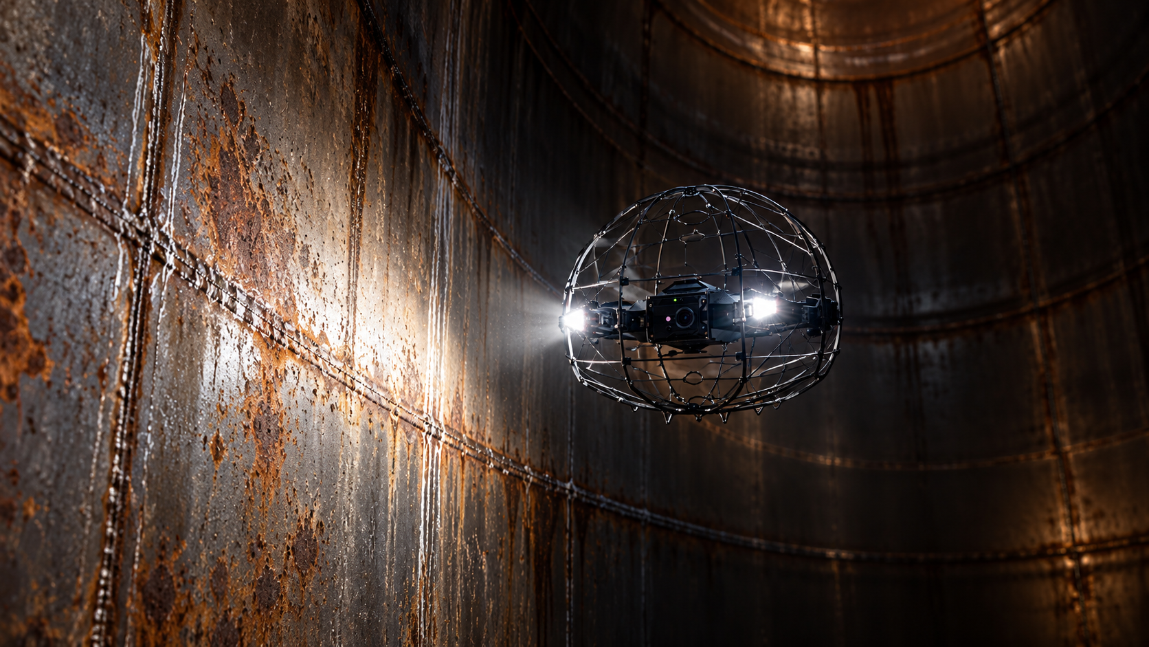
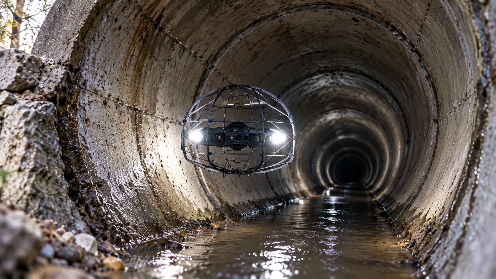
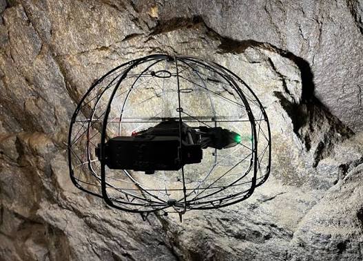
Underground Mine Inspections Specialist collision-tolerant dronesUnderground workings generally lack reliable GNSS positioning and may contain confined passages, restricted openings, poor lighting and difficult radio conditions. Flybotix ASIO X: A specialist indoor inspection drone designed for challenging enclosed environments. Protected design: Helps manage incidental contact with suitable internal surfaces. Inspection lighting: Supports visual examination in dark enclosed structures. Indoor operation: Requires suitable flight-control methods and trained operators in GPS-denied environments. Underground use depends on atmospheric safety, ventilation, access, communications, equipment suitability and recovery arrangements. |
Underground Rock Face Inspections
In suitable underground environments, collision-tolerant drones can help operators obtain visual records of accessible rock faces and chambers without relying on conventional outdoor flight platforms.
|
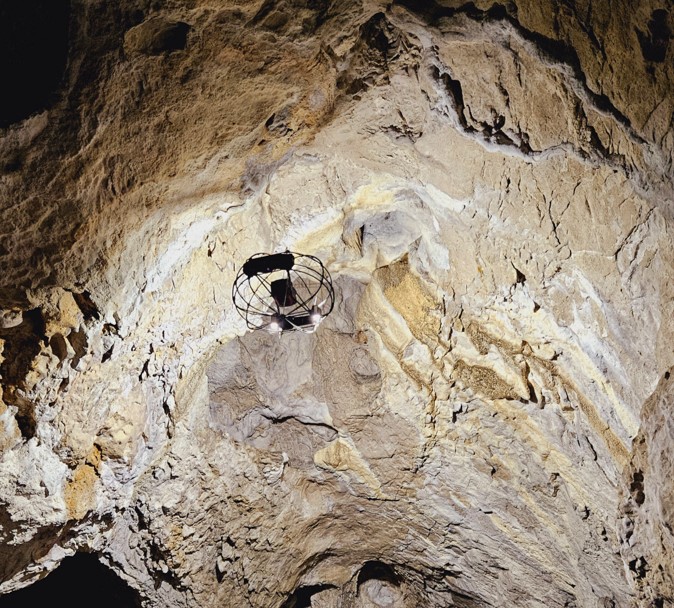
Underground Mine Inspection The Flybotix ASIO X illustrates how a specialist indoor drone can be deployed to document accessible rock surfaces and enclosed mining structures in an appropriately assessed environment. |
Rock Face Visual Documentation Collision-tolerant systems can help gather close visual information about accessible surfaces and structures where the operating conditions allow safe flight. |
Equipment suitability:
The Flybotix ASIO X is not presented here as an external quarry highwall survey aircraft. It is included specifically for underground and enclosed inspection applications. Collision tolerance does not mean a drone is certified for explosive atmospheres or safe for every underground mine.
Why It Matters
Appropriate drone inspections can complement geological and geotechnical investigations by providing detailed information from difficult-to-access environments.
Support Safer Inspection PlanningRemote observation may reduce the need for some personnel to approach difficult or potentially unstable rock faces. |
Improve Geotechnical EvidenceDetailed visual and spatial records provide information that specialists can use within their assessment processes. |
Document Change Over TimeComparable surveys can support records of changing rock face geometry and visible conditions. |
|
Planning Rock Face Inspections
The inspection method must suit the environment.
|
Planning Considerations What should quarry and mine operators consider?
Is the inspection external or underground?
This determines the aircraft type, navigation method and operating constraints.
What is the inspection objective?
Visual documentation, rock face geometry, change monitoring or specialist investigation support.
What hazards are present?
Review ground stability, excavation activities, atmospheric conditions, weather and access restrictions.
What outputs are required?
Agree photographs, spatial records, 3D models, point clouds and reporting detail.
Who will review the findings?
Identify the competent geological, geotechnical or engineering personnel responsible for assessment. |
Whatever you need drones to do, there are three ways to work with Iprosurv.
Our pilots carry out the survey or inspection and deliver the data and reports you need.
Accredited courses that give you and your team the skills to fly safely and legally.
The drones, sensors and software to run your own operations, with expert advice.
Tell us what you are trying to achieve and we will recommend the right service, training or equipment.