Drone technology continues building on solid foundations in construction
During the early stages of the project, drones can play an important role in the levelling of the prospective site. due to the Geo tagged images and onboard sensors the drone can take land level calculations it can then through specific software calculate cut and fill amounts and locations. Stockpiles can also be monitored to ensure safety and compliance.
All this can be converted into a site-specific report for all stakeholders.
Progress monitoring
Many of the latest drone systems incorporate advanced situational and positional awareness for enhanced security and in-the-moment evaluation, response, and planning. Drones make the production of weekly progress maps far quicker, easier, and less costly than traditional methods. They also facilitate greater and easier information exchanges between construction companies and their clients, boosting overall efficiency, transparency, and communication.
Security, maintenance, data
Security must be one of the main contributing factors to site safety using drones can allow site managers and stakeholders to quickly assess the installation and maintenance of security measures such as fencing, on-site cameras, equipment security and storage etc.
Using thermal cameras can give added security to help monitor and detect site activity during silent hours.
Due to the height of operations of the drone, a unique data aspect can be obtained to identify further risks such as proximity issues of waste and storage or other materials which could cause fire hazards and other issues.
Where areas are completely inaccessible, drones can be used and where there’s uncertainty about safety issues, drone technology can be used to save time as well as minimize risk. For example, drones can analyze roof structures from above, and with the use of a specialist internal drone which can be used in internal structures to gather data.
Risk and safety management
Any areas considered too risky for sending in personnel, such as dangerous structures, areas where hazardous materials are leaking or where there’s risk of fire from flammable materials, mean using a drone presents a safer option as the drone operator can remain at a safe distance.
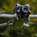
Specialist drones can be employed where access is restricted with onboard thermal, RGB cameras, and high-intensity spotlights all housed in a collision-proof cage to avoid damage.
In-house or outsourced model
We know that one size never fits all, so we tailor our services to your needs. We can provide a full service of the pilot, equipment, data collection and, delivery.
Or if you want to add drones to your workflow, we can help you manage your drone proposition, source pilots and we’ll take care of all aspects of the drone management down to licensing and provide a white-labelled case management system for the delivery and monitoring of your data.
Contact
For further information, contact info@iprosurv.com
About Iprosurv
Established in 2014, Iprosurv provides companies with the in-house capability of drone and data/media delivery services. Our CAMERA system and optimum drone operator platform provides bespoke services be that an on-demand, fully managed service to independent data/media delivery services.
Iprosurv is a pioneer in the provision of drone technology across a range of industries. Its current network of pilots, covering the entirety of the UK, use a proprietary system to record, store and deliver drone data to clients in a fast and secure way. From building surveys to flood response to assisting emergency services, Iprosurv continues to push the boundaries of how drones can be used in business.
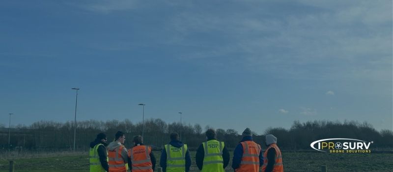
Managing a construction project is no small task. From tracking site progress and monitoring safety, overseeing subcontractors and, keeping stakeholders informed, there is almost no end to the level of coordination required on any given day.
It’s no wonder project managers on job sites of all sizes are turning to drones for support. The construction industry has been one of the earliest and most enthusiastic adopters of drone technology. In the last year alone, the commercial drone industry has grown 240%, and much of that growth is driven by the construction industry.
Aerial photos, maps, and 3D models have the power to transform your workflow.
Not only can drones save your construction projects money and resources, but they also give your team a technical set of data for more informed communication and decision-making.
Sites can be monitored at any time interval to allow new data on the progress of the site to maintain an efficient workflow and site monitoring.
Mapping and 3D modelling
Alongside surveys, innovation in drone software systems allows accurate contour maps and 3D models to be produced, based on footage and data gathered.
The process of high-resolution aerial imagery 3D modelling comes in
various formats but essentially enables images of the whole project area to be captured and merged into a comprehensive model of the area.
2D images can also be generated based on mapping technology.
Whilst 3D imagery offers full model benefits, 2D images allow accurate measurements and adjustment.
One data set – multiple outputs
In most cases a single data set can be used in multiple outputs producing an Orth mosaic 2D image to look at the whole site in minute detail allowing you to assess site progress, safety issues and anything else you need to monitor.
As a 2d data set this is taking imagery in NADIR (camera facing straight down), it is very hard to understand levels and relief on the ground.
Using the same data set a DTM (Digital Terrain Model) can be produced at the same time, allowing site managers and planners to understand the elevation of the site, heights, and levels.
Cut and fill and volumetric
During the early stages of the project, drones can play an important role in the levelling of the prospective site. due to the Geo tagged images and onboard sensors the drone can take land level calculations it can then through specific software calculate cut and fill amounts and locations. Stockpiles can also be monitored to ensure safety and compliance.
All this can be converted into a site-specific report for all stakeholders.
Progress monitoring
Many of the latest drone systems incorporate advanced situational and positional awareness for enhanced security and in-the-moment evaluation, response, and planning. Drones make the production of weekly progress maps far quicker, easier, and less costly than traditional methods. They also facilitate greater and easier information exchanges between construction companies and their clients, boosting overall efficiency, transparency, and communication.
Security, maintenance, data
Security must be one of the main contributing factors to site safety using drones can allow site managers and stakeholders to quickly assess the installation and maintenance of security measures such as fencing, on-site cameras, equipment security and storage etc.
Using thermal cameras can give added security to help monitor and detect site activity during silent hours.
Due to the height of operations of the drone, a unique data aspect can be obtained to identify further risks such as proximity issues of waste and storage or other materials which could cause fire hazards and other issues.
Where areas are completely inaccessible, drones can be used and where there’s uncertainty about safety issues, drone technology can be used to save time as well as minimize risk. For example, drones can analyze roof structures from above, and with the use of a specialist internal drone which can be used in internal structures to gather data.
Risk and safety management
Any areas considered too risky for sending in personnel, such as dangerous structures, areas where hazardous materials are leaking or where there’s risk of fire from flammable materials, mean using a drone presents a safer option as the drone operator can remain at a safe distance.
Specialist drones can be employed where access is restricted with onboard thermal, RGB cameras, and high-intensity spotlights all housed in a collision-proof cage to avoid damage.
In-house or outsourced model
We know that one size never fits all, so we tailor our services to your needs. We can provide a full service of the pilot, equipment, data collection and, delivery.
Or if you want to add drones to your workflow, we can help you manage your drone proposition, source pilots and we’ll take care of all aspects of the drone management down to licensing and provide a white-labelled case management system for the delivery and monitoring of your data.
Contact
For further information, contact info@iprosurv.com
About Iprosurv
Established in 2014, Iprosurv provides companies with the in-house capability of drone and data/media delivery services. Our CAMERA system and optimum drone operator platform provides bespoke services be that an on-demand, fully managed service to independent data/media delivery services.
Iprosurv is a pioneer in the provision of drone technology across a range of industries. Its current network of pilots, covering the entirety of the UK, use a proprietary system to record, store and deliver drone data to clients in a fast and secure way. From building surveys to flood response to assisting emergency services, Iprosurv continues to push the boundaries of how drones can be used in business.