Windblown forestry, storm Arwen, and Drone Technology
They have no limited time frame of functioning or power issues and can produce results conveniently. Despite these qualities, satellites encompass a fair number of demerits that include compressed and sketchy aerial imagery as opposed to those captured by drones and UAVs.
Overcoming the disparate challenges and obstacles that come in the way of forestry, drone technology has helped surpass the same through its varied applications. Thrusting the abstraction of aerial imagery and monitoring, drone applications have brought the specialization of topographic surveillance, aerial photography, thermal imagery, and more to the forefront of forest cultivation.
The flexibility of drones allows them to capture high-resolution images and video in real-time, even during the humid tropical climate. Artificial Intelligence-powered drones, along with drones that use LiDAR (Light Detection and Ranging) and NDVI (Normalised Differential Vegetation Index) can monitor and inspect large areas with focussed coverage that yields faster and more precise results and data.
Introducing drones into your business
At Iprosurv we understand that taking on new technology can be daunting especially when there is so much to consider, types of drone, applications, software outputs, regulation and training. it easy to understand why some businesses just decide to avoid implementing drones into their workflow.
That’s why we run advice, guidance, and consultancy service, to offer businesses the opportunity to explore the use of drones without the cost, see our page on “Drones in your business, advice, guidance, consultancy”. to see if you would like to explore any of the services we offer whether that be, a house managed service, Iprosurv managed service or, expanding on your current drone operations.
The future of forestry
With the speed of deployment and the addition of multiple data outputs, GIS integration, health and safety mitigation, area coverage, and not forgetting cost as opposed to more traditional methods drones have to be a consideration within your forestry management workflow.
Redefining the elements of forestry, drone technology entails merits towards the progress and advancement of the forest ecosystems. Drones, in this realm, push the boundaries of forest cultivation and maintenance, redeeming wildlife and vegetation, while also monitoring risks to prevent the felling of trees. With the adoption of drones, forestry can witness a high cascade of improvement and growth, like never before!
As well as devastation to property, infrastructure, and utilities, large areas of woodland were devastated with more than approximately 1 million Metric tonnes of windblown trees and an estimated 4000 hectares of land (just smaller than Dundee) roughly 1/3 of what would be felled nationally in a given year.
Although windblown events are rare and hard to predict, when they happen the after-effects can be devastating with forestry management plans shattered, plans that could have been planned to encompass forest management and timber felling and replanting, sustainability for the next 5 or 10 years.
Forestry and Estate managers have a huge task calculating affected areas, clearance, felling permissions, all before a plan for replanting.
Windblown areas can be highly dangerous areas with uprooted trees blocking access partly fallen and weak trees ready to fall at any time, some weighing over 3500 kilos (3.5 tonnes) creating a serious risk to life for forest workers.
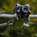
Application of drone technology
Utilising drone technology at the right time can improve workflow by gathering vital data in the hours and days after an that can help facilitate quicker applications for felling, understanding the site and the extent of the damage, access routes, damage to utilities and other structures, priority clearance.
If the data is collected correctly the production of Ortho-mosaic topography, lidar maps, digital terrain models, digital surface models.
Multiple file formats Tif, Tiff for import into GIS high-definition JPEG, 4k video, LIDAR, NDVI and NDRE, Thermal the information using the correct platform such as Iprosurv’s proprietary platform could be shared instantly with multiple stakeholders, insurers, loss adjusters, government organisations, contractors, forestry managers, and owners but to name a few.
Satellite Imagery vs Drone
By their true essence, Satellites have been immensely useful in the space of monitoring and surveillance by providing imagery and wide visual content. Their dynamic abilities help capture bountiful facets associated with many industries in which forestry is one of them.
They have no limited time frame of functioning or power issues and can produce results conveniently. Despite these qualities, satellites encompass a fair number of demerits that include compressed and sketchy aerial imagery as opposed to those captured by drones and UAVs.
Overcoming the disparate challenges and obstacles that come in the way of forestry, drone technology has helped surpass the same through its varied applications. Thrusting the abstraction of aerial imagery and monitoring, drone applications have brought the specialization of topographic surveillance, aerial photography, thermal imagery, and more to the forefront of forest cultivation.
The flexibility of drones allows them to capture high-resolution images and video in real-time, even during the humid tropical climate. Artificial Intelligence-powered drones, along with drones that use LiDAR (Light Detection and Ranging) and NDVI (Normalised Differential Vegetation Index) can monitor and inspect large areas with focussed coverage that yields faster and more precise results and data.
Introducing drones into your business
At Iprosurv we understand that taking on new technology can be daunting especially when there is so much to consider, types of drone, applications, software outputs, regulation and training. it easy to understand why some businesses just decide to avoid implementing drones into their workflow.
That’s why we run advice, guidance, and consultancy service, to offer businesses the opportunity to explore the use of drones without the cost, see our page on “Drones in your business, advice, guidance, consultancy”. to see if you would like to explore any of the services we offer whether that be, a house managed service, Iprosurv managed service or, expanding on your current drone operations.
The future of forestry
With the speed of deployment and the addition of multiple data outputs, GIS integration, health and safety mitigation, area coverage, and not forgetting cost as opposed to more traditional methods drones have to be a consideration within your forestry management workflow.
Redefining the elements of forestry, drone technology entails merits towards the progress and advancement of the forest ecosystems. Drones, in this realm, push the boundaries of forest cultivation and maintenance, redeeming wildlife and vegetation, while also monitoring risks to prevent the felling of trees. With the adoption of drones, forestry can witness a high cascade of improvement and growth, like never before!
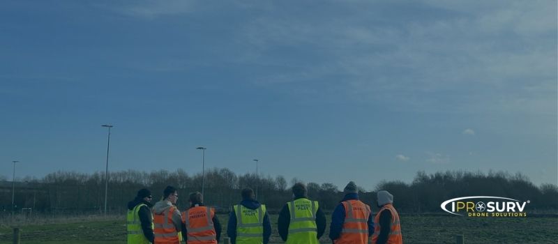
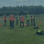
The winds of change, Windblown forestry, storm Arwen and Drone Technology, The monitoring and observance of forests and woodlands can pose a tiresome and exhaustive process in a sense that requires an abundant amount of workforce and skills and appropriate resources. when a catastrophic event hits it it becomes increasingly difficult for the forestry managers and workers to take immediate action owing to the large span of areas that constitute forests and the dangers that it produces.
As a means of relief, Unmanned Aerial Vehicles (UAVs) help in terms of aerial surveillance, mapping, aerial photography, thermal imagery, and topographic monitoring. Subsequently, enabling forestry managers to take swift and immediate action and make increased and faster decisions based on real time data. this also aids in wildlife conservation, biodiversity and vegetation conservation, the balance of ecology, and similar aspects of forestry by getting back to normal as quickly as possible.
Tree health and disease detection
Artificial Intelligence and Machine Learning fuelling the drones have proved beneficial in the space of tree disease detection and prevention. LiDAR sensors in drones help accumulate and process data attributed to the wellbeing of trees, vegetation, and bushlands. Thermal imagery, topographic surveying, aerial mapping help locate diseased flora and navigate horticulturists and forest officials towards improving their conditions.
Windblown Storm Arwen
In November 2021 parts of the UK and predominantly the Scottish Borders and Cumbria were hit with winds gusting more than 75mph with the highest being 98mph in Northumberland.
As well as devastation to property, infrastructure, and utilities, large areas of woodland were devastated with more than approximately 1 million Metric tonnes of windblown trees and an estimated 4000 hectares of land (just smaller than Dundee) roughly 1/3 of what would be felled nationally in a given year.
Although windblown events are rare and hard to predict, when they happen the after-effects can be devastating with forestry management plans shattered, plans that could have been planned to encompass forest management and timber felling and replanting, sustainability for the next 5 or 10 years.
Forestry and Estate managers have a huge task calculating affected areas, clearance, felling permissions, all before a plan for replanting.
Windblown areas can be highly dangerous areas with uprooted trees blocking access partly fallen and weak trees ready to fall at any time, some weighing over 3500 kilos (3.5 tonnes) creating a serious risk to life for forest workers.
Application of drone technology
Utilising drone technology at the right time can improve workflow by gathering vital data in the hours and days after an that can help facilitate quicker applications for felling, understanding the site and the extent of the damage, access routes, damage to utilities and other structures, priority clearance.
If the data is collected correctly the production of Ortho-mosaic topography, lidar maps, digital terrain models, digital surface models.
Multiple file formats Tif, Tiff for import into GIS high-definition JPEG, 4k video, LIDAR, NDVI and NDRE, Thermal the information using the correct platform such as Iprosurv’s proprietary platform could be shared instantly with multiple stakeholders, insurers, loss adjusters, government organisations, contractors, forestry managers, and owners but to name a few.
Satellite Imagery vs Drone
By their true essence, Satellites have been immensely useful in the space of monitoring and surveillance by providing imagery and wide visual content. Their dynamic abilities help capture bountiful facets associated with many industries in which forestry is one of them.
They have no limited time frame of functioning or power issues and can produce results conveniently. Despite these qualities, satellites encompass a fair number of demerits that include compressed and sketchy aerial imagery as opposed to those captured by drones and UAVs.
Overcoming the disparate challenges and obstacles that come in the way of forestry, drone technology has helped surpass the same through its varied applications. Thrusting the abstraction of aerial imagery and monitoring, drone applications have brought the specialization of topographic surveillance, aerial photography, thermal imagery, and more to the forefront of forest cultivation.
The flexibility of drones allows them to capture high-resolution images and video in real-time, even during the humid tropical climate. Artificial Intelligence-powered drones, along with drones that use LiDAR (Light Detection and Ranging) and NDVI (Normalised Differential Vegetation Index) can monitor and inspect large areas with focussed coverage that yields faster and more precise results and data.
Introducing drones into your business
At Iprosurv we understand that taking on new technology can be daunting especially when there is so much to consider, types of drone, applications, software outputs, regulation and training. it easy to understand why some businesses just decide to avoid implementing drones into their workflow.
That’s why we run advice, guidance, and consultancy service, to offer businesses the opportunity to explore the use of drones without the cost, see our page on “Drones in your business, advice, guidance, consultancy”. to see if you would like to explore any of the services we offer whether that be, a house managed service, Iprosurv managed service or, expanding on your current drone operations.
The future of forestry
With the speed of deployment and the addition of multiple data outputs, GIS integration, health and safety mitigation, area coverage, and not forgetting cost as opposed to more traditional methods drones have to be a consideration within your forestry management workflow.
Redefining the elements of forestry, drone technology entails merits towards the progress and advancement of the forest ecosystems. Drones, in this realm, push the boundaries of forest cultivation and maintenance, redeeming wildlife and vegetation, while also monitoring risks to prevent the felling of trees. With the adoption of drones, forestry can witness a high cascade of improvement and growth, like never before!