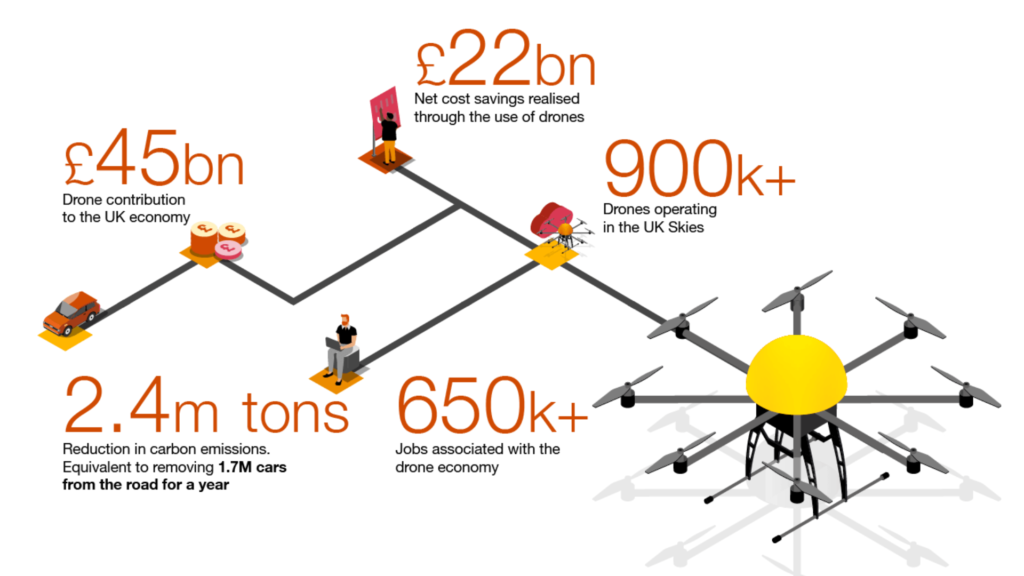
Lack Of Awareness About The Benefits Of Drones Technology Could Be Impacting Development Of Insurance Sector