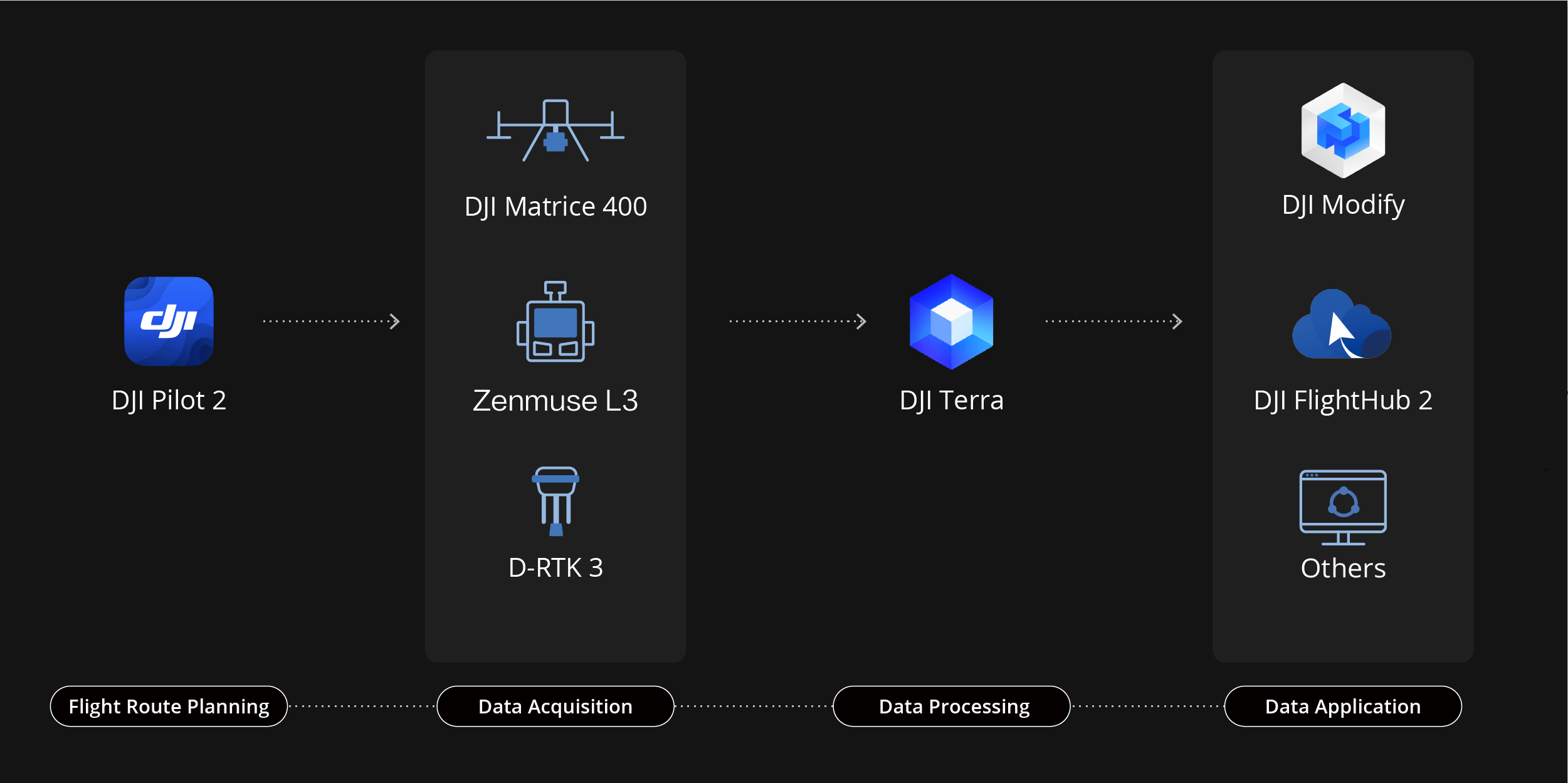
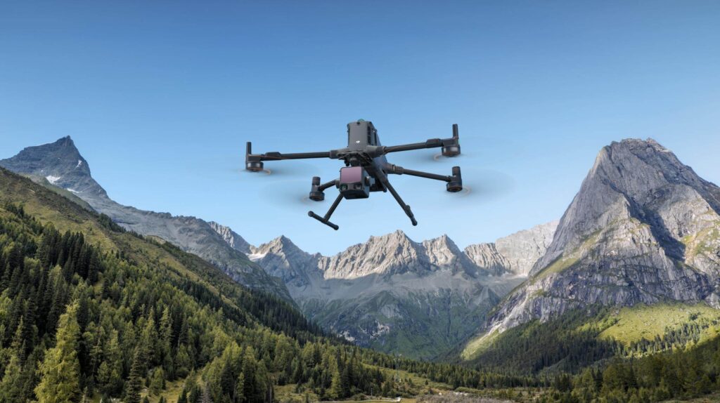
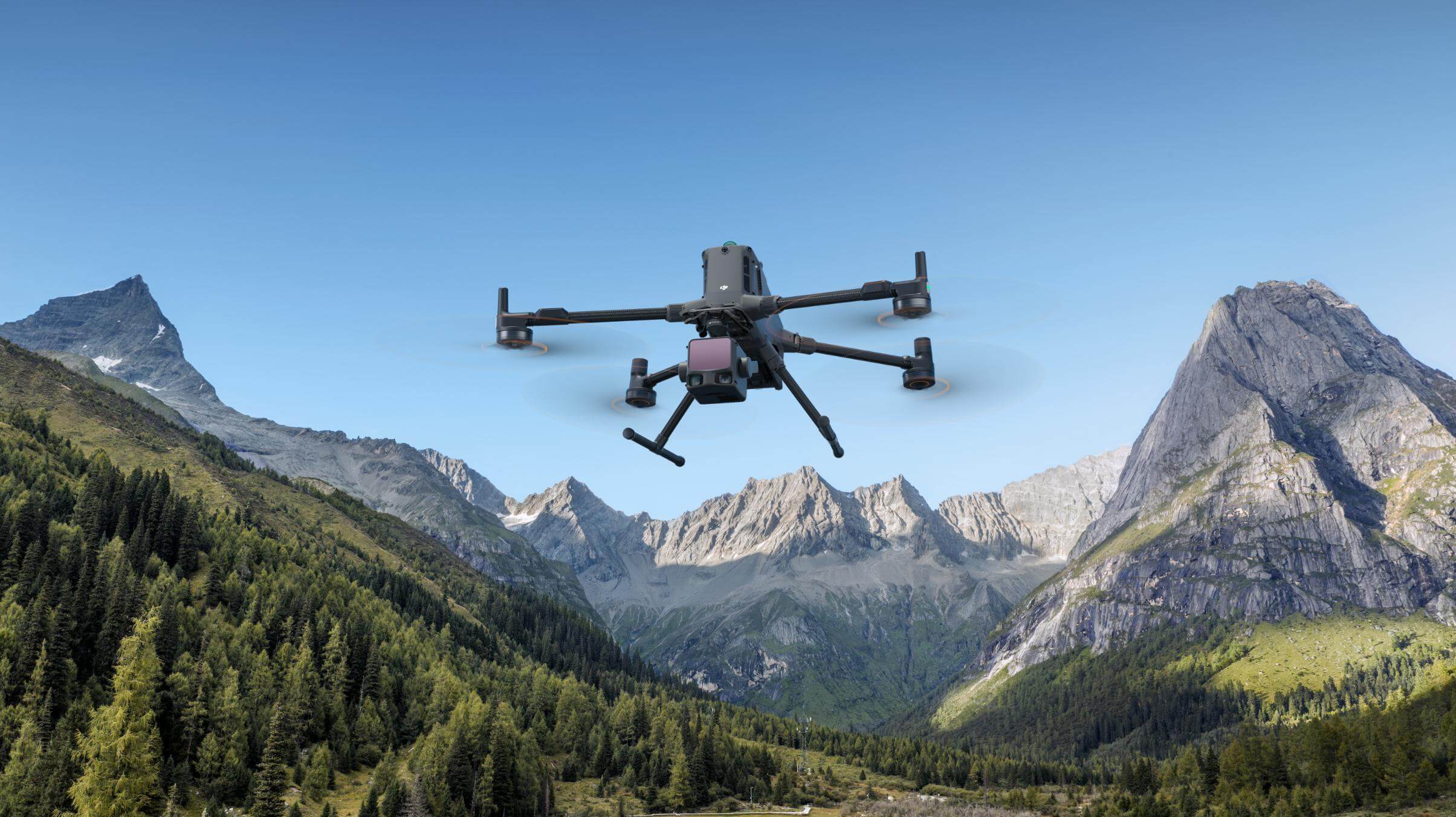
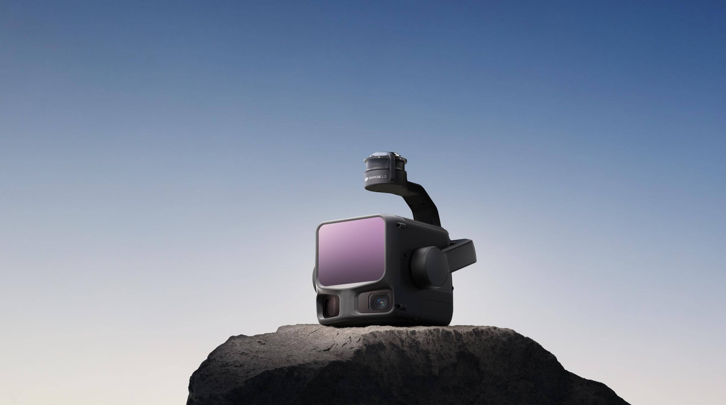
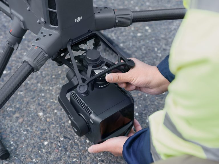
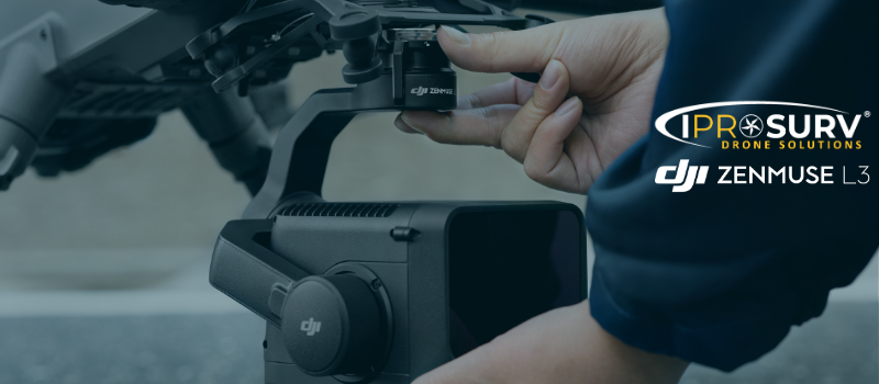
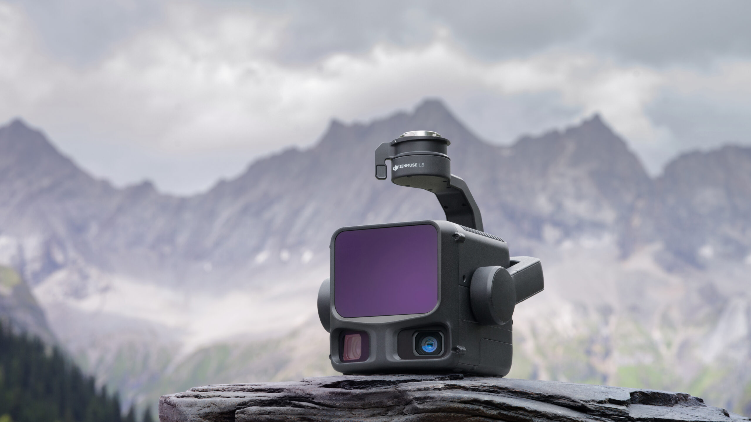
DJI’s next-generation high-accuracy aerial LiDAR system features a long-range LiDAR capable of reaching up to 950 m even on objects with just 10% reflectivity. Dual 100MP RGB mapping cameras and a high-precision POS system accelerate geospatial data acquisition, enabling daily coverage of up to 100 km² [2].
DJI Zenmuse L3
High-Precision IMU
- Heading accuracy 0.02° (post-processed)
- Pitch/Roll accuracy 0.01°
- 200 Hz POS refresh rate
- Instant startup – no preheating required
- Automatic calibration during flight for heading and pitch/roll
- Zero manual calibration for manual missions
Dual 100 MP Camera System
- Dual Micro 4/3 CMOS sensors (100 MP native / 25 MP fast mode)
- Up to 1.2 cm GSD @ 120 m / 3 cm @ 300 m
- Ultra-wide FOV 107° (27° wider than LiDAR coverage)
- Shooting intervals: 1.0 s (100 MP) / 0.5 s (25 MP)
- 500,000-cycle mechanical shutter
- Strong low-light performance
Design & Compatibility
- Built for the DJI Matrice 400 only
- New anti-drop gimbal bracket (included)
- Weight 1.6 kg
- 3-axis gimbal: Pitch –120° to +60°, Yaw –80° to +80°, Roll –90° to +60°
- IP54 rated, operational –25 °C to +55 °C
- Quick-connect SkyPort mount
- Not compatible with M350 due to power draw
End-to-End Mapping with DJI Terra & DJI Modify
- Complete Workflow: Go from point cloud to 3D model within one connected DJI ecosystem.
- Powerful Integration: Combine DJI L3 with DJI Terra, DJI Modify, DJI FlightHub 2, and third-party tools like Terrasolid.
- Precision Results: DJI Terra delivers PPK accuracy, Gaussian Splatting for lifelike visuals, and fusion-based modelling for 2D maps and 3D meshes.
- Professional Outputs: DJI Modify enables easy point cloud classification, cross-section analysis, and generation of DEM, TIN, grids, and contours.
- For Professionals: Streamlined project management for surveyors, GIS specialists, and CAD engineers seeking speed, accuracy, and efficiency.


